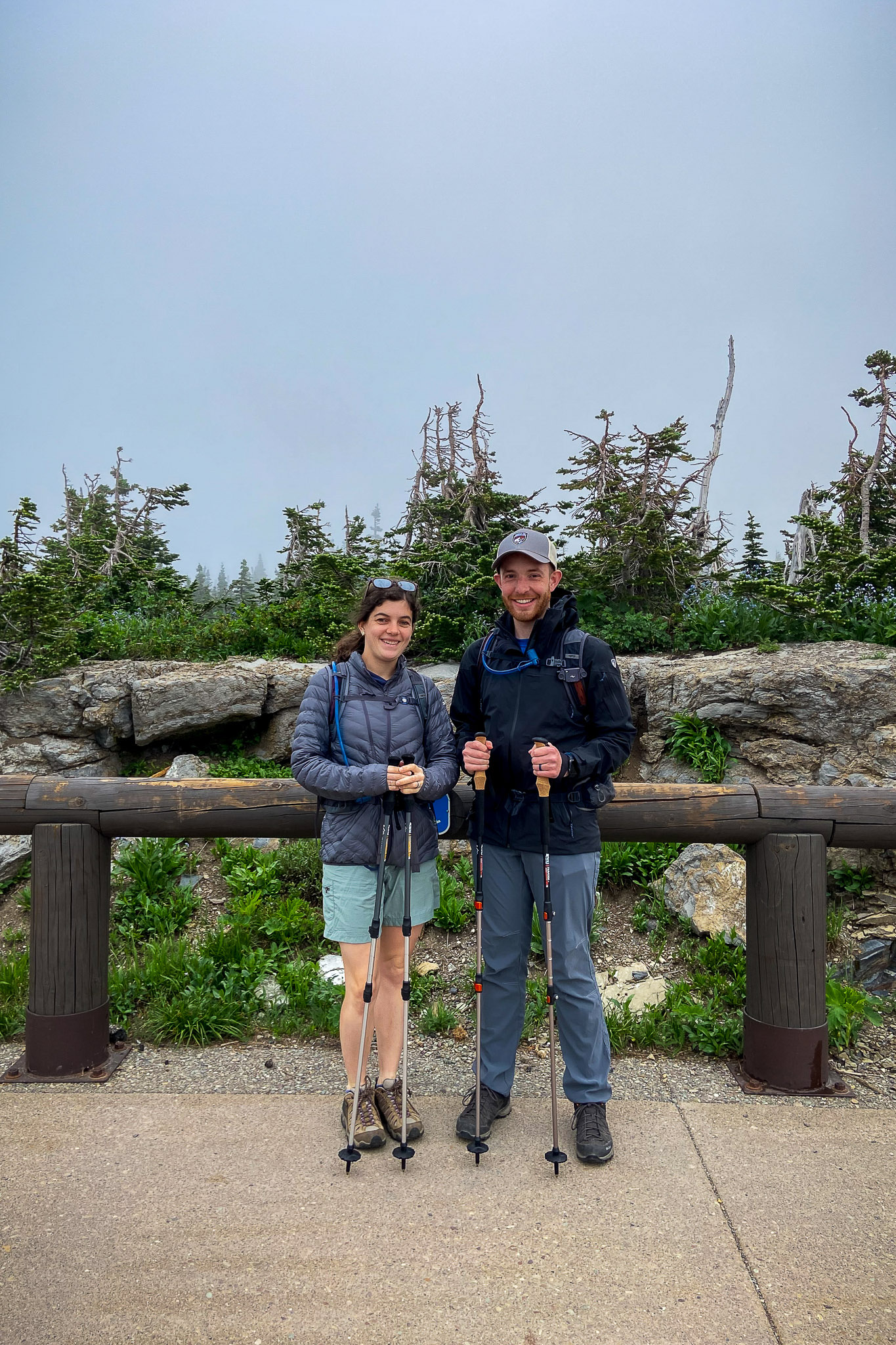
Today Faith and I hiked the Highline Trail in Glacier National Park, while Mom and Dad had their own adventure. In the evening, we drove over to Whitefish for dinner and ice cream, then stopped at Lake McDonald in the evening.
Glacier National Park
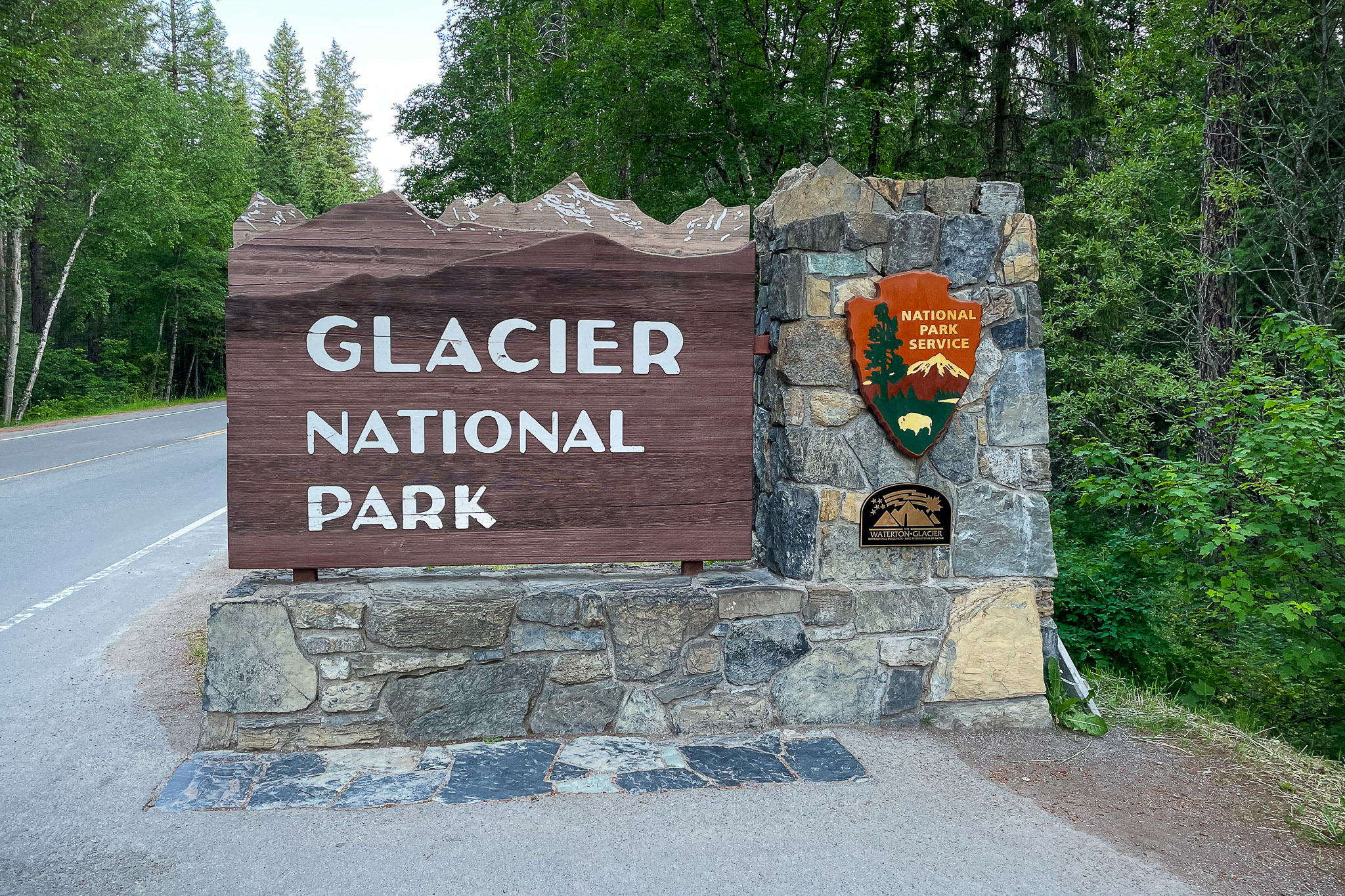
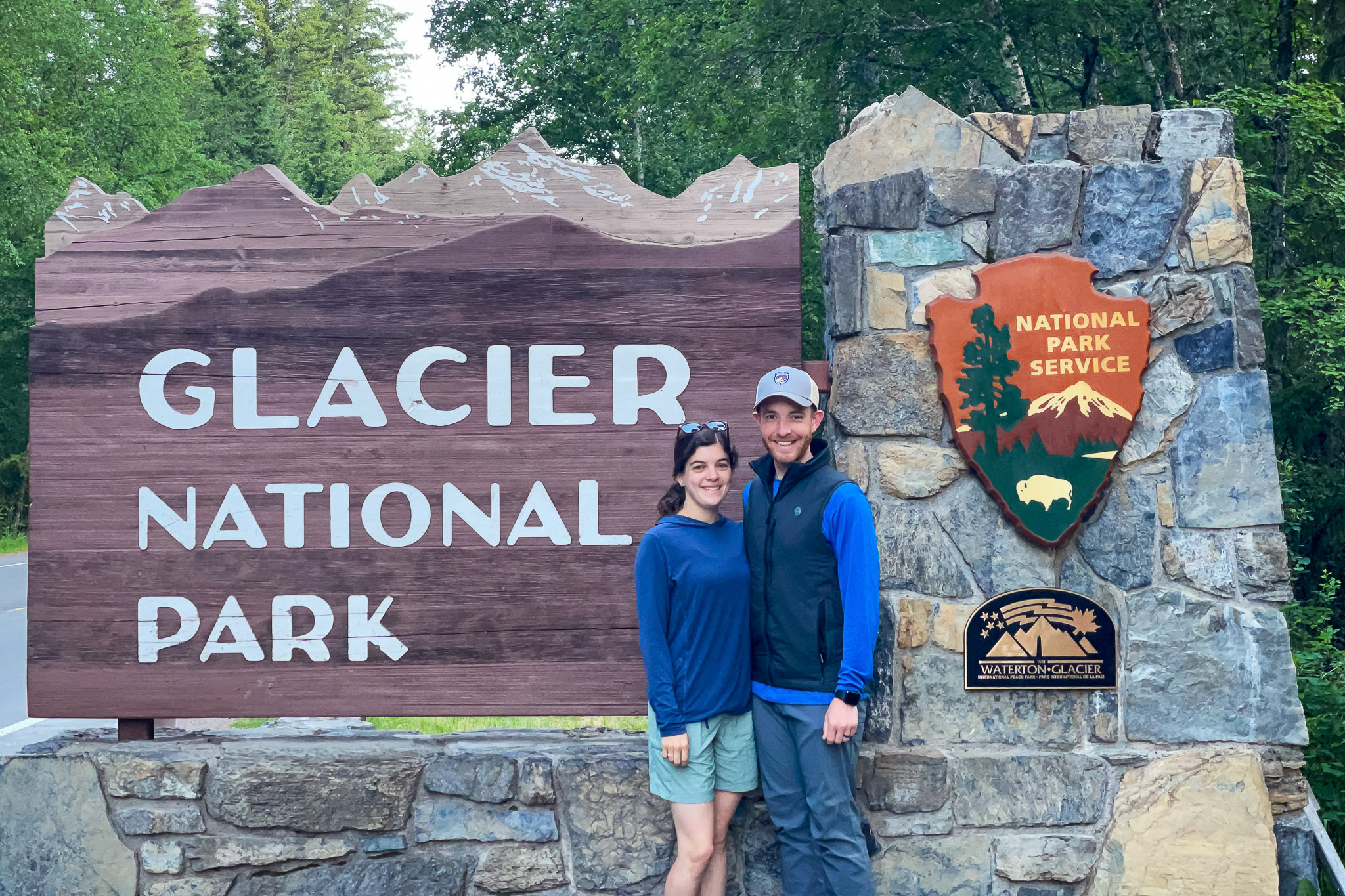
This morning, we were back to an early start again, this time leaving the cabin at 05:00. We packed up the car, left our cabin and the encroaching chickens, and headed towards the park. After stopping for a quick obligatory picture at the entrance sign, we retraced our steps from the previous evening and passed the long shore of Lake McDonald.
- Established on May 11, 1910
- 1,012,837 acres (1,583 sq mi)
- 175 mountains
- 26 remaining glaciers
- Harrison Glacier is the largest, at 1,661,456 sq meters
- 131 names lakes, 631 unnamed
- Named after the 13,775′ Grand Teton, the tallest mountain in the 40mi-long Teton Range
- Lowest elevation: 3,150′ (Flathead River)
- Average elevation: 5,105′
- Highest Elevation: 10,448′ (Mt. Cleveland)
- 700+ mi of hiking trails
- 2-3M visitors annually, most of them from June-September
- 71 species of mammals
- Lake McDonald is the largest lake, at 9.4mi long, 1.5mi wide, and 464′ deep
- The park borders Waterton Lakes National Park of Canada. Together, they form the world’s first International Peace Park.
- The Goat Haunt Ranger Station in Glacier can only be accessed via long hiking trails, or by taking a boat from Waterton Lakes, AB.
- Because the park straddles the Continental Divide, weather can be highly unpredictable due to opposing fronts from the Arctic and Pacific Oceans. Recorded temperatures have dropped more than 100 degrees in 24 hours.
- The Great Northern Railway constructed 9 chalets for visitors to stay in. In the early days of the park, most stayed longer than a month.
- The mountain goat is the official symbol of the park.
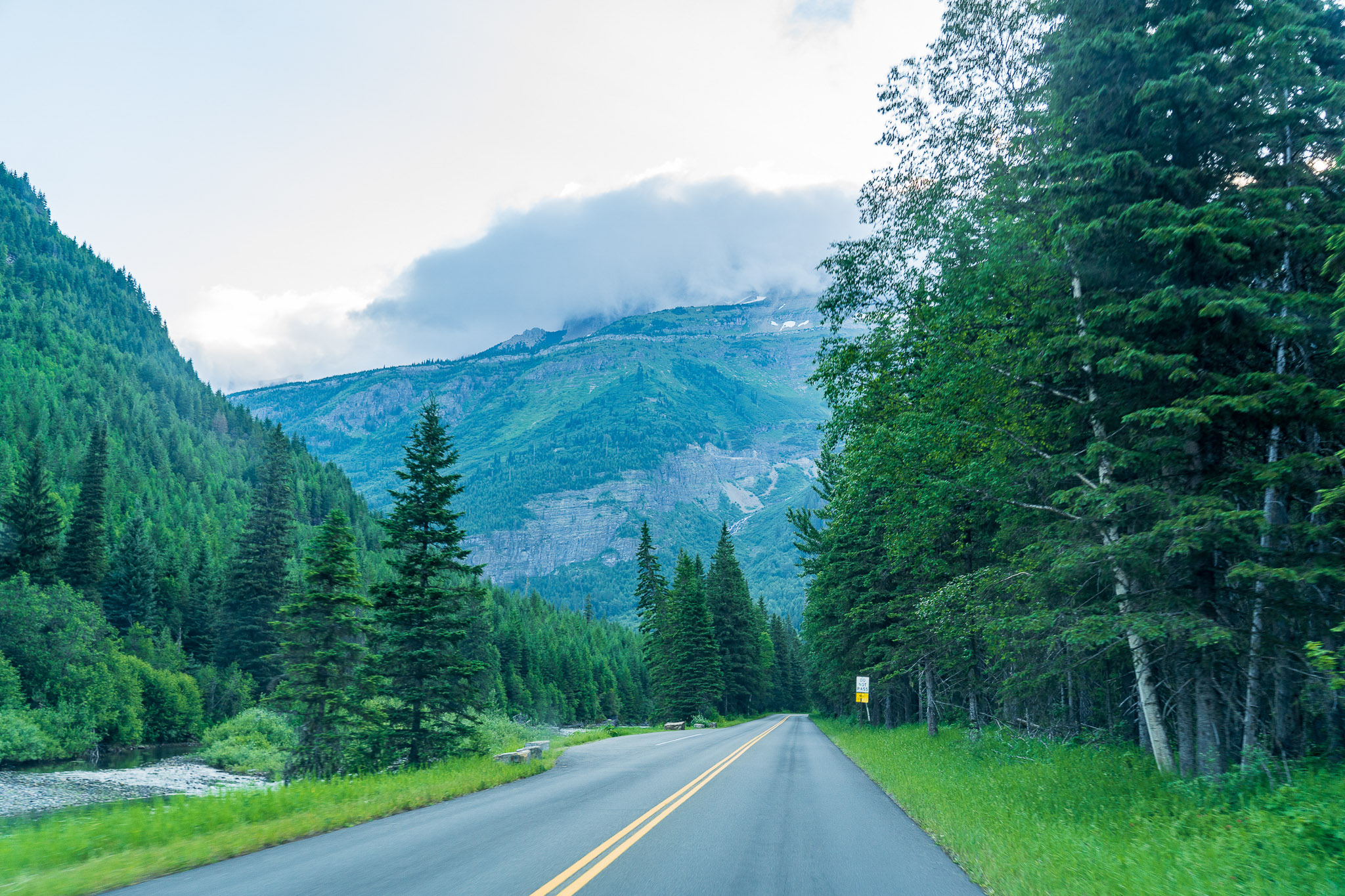
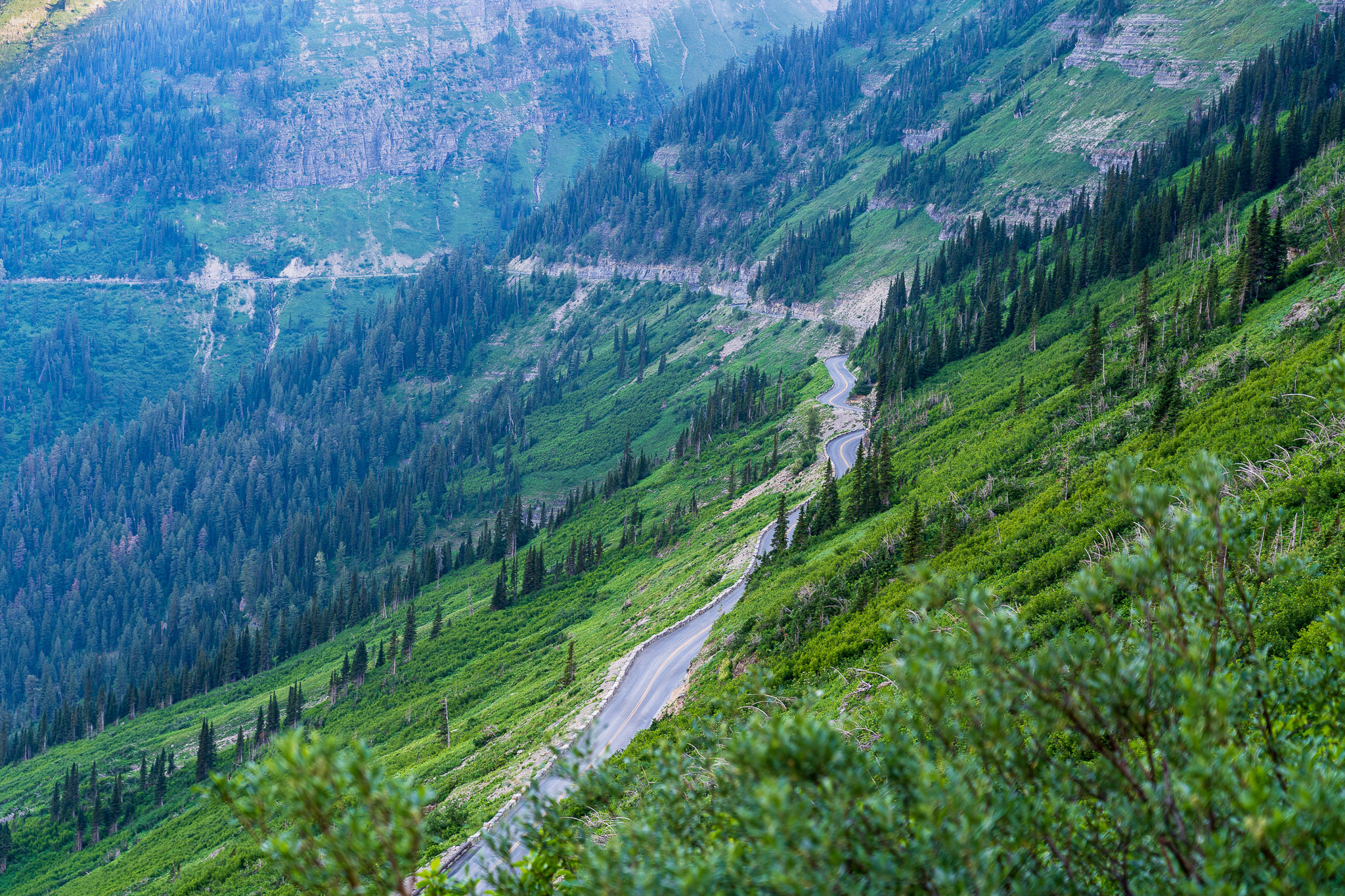
Climbing the Going to the Sun Road, we were now high in the mountains. From Logan Pass, the highest point of the road, Faith and I would begin the Highline Trail, while Mom and Dad went to eat breakfast outside the park. We planned to meet them later in the day at the other end of the trail. In another post, I’ll share more info about the road.
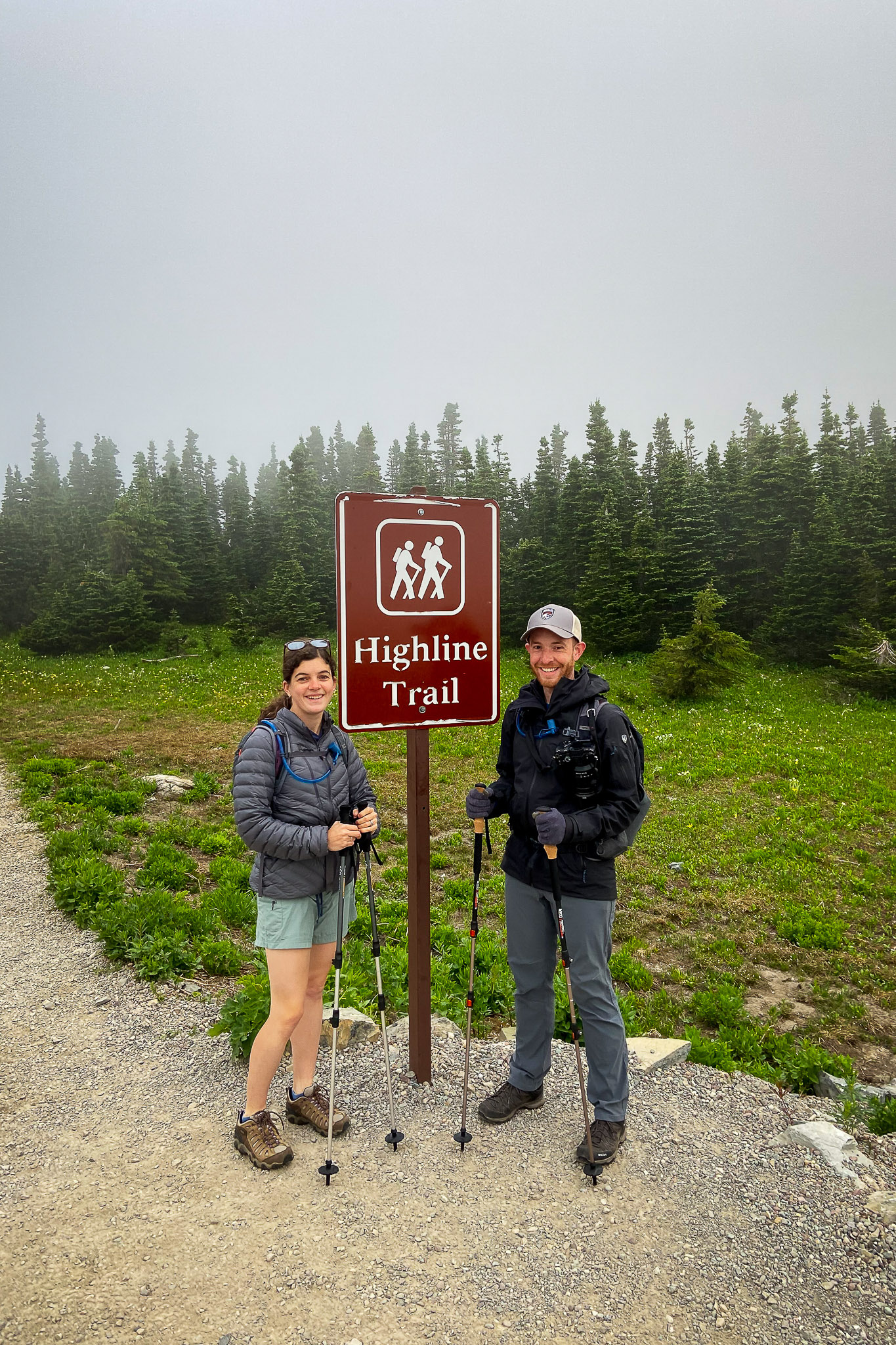
Highline Trail - Beginning
After climbing the Going to the Sun Road for a while, we arrived at Logan Pass Visitor Center (where most people start the Highline Trail). The parking lot often fills up by 07:00 every morning.
The Highline Trail officially runs 11.2 miles from Logan Pass to Granite Park Chalet. Our planned route for the day would take us closer to 15 miles, or maybe longer, depending on how many stops and detours we decided to make.
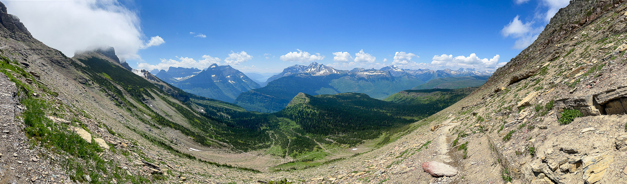
Highline Trail - In the Clouds
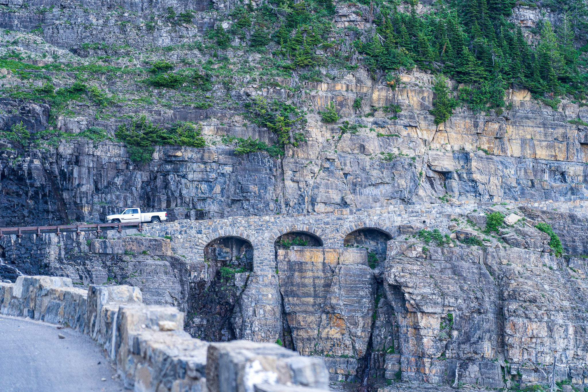
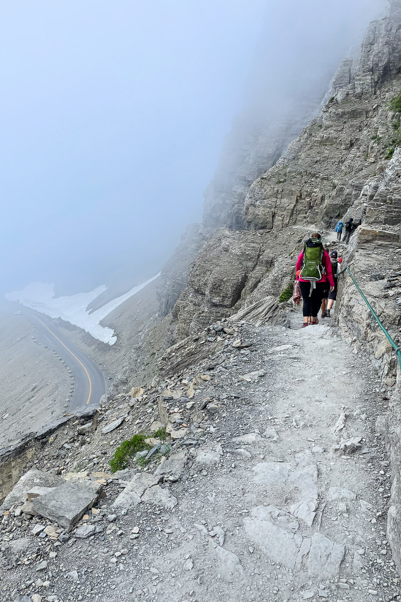
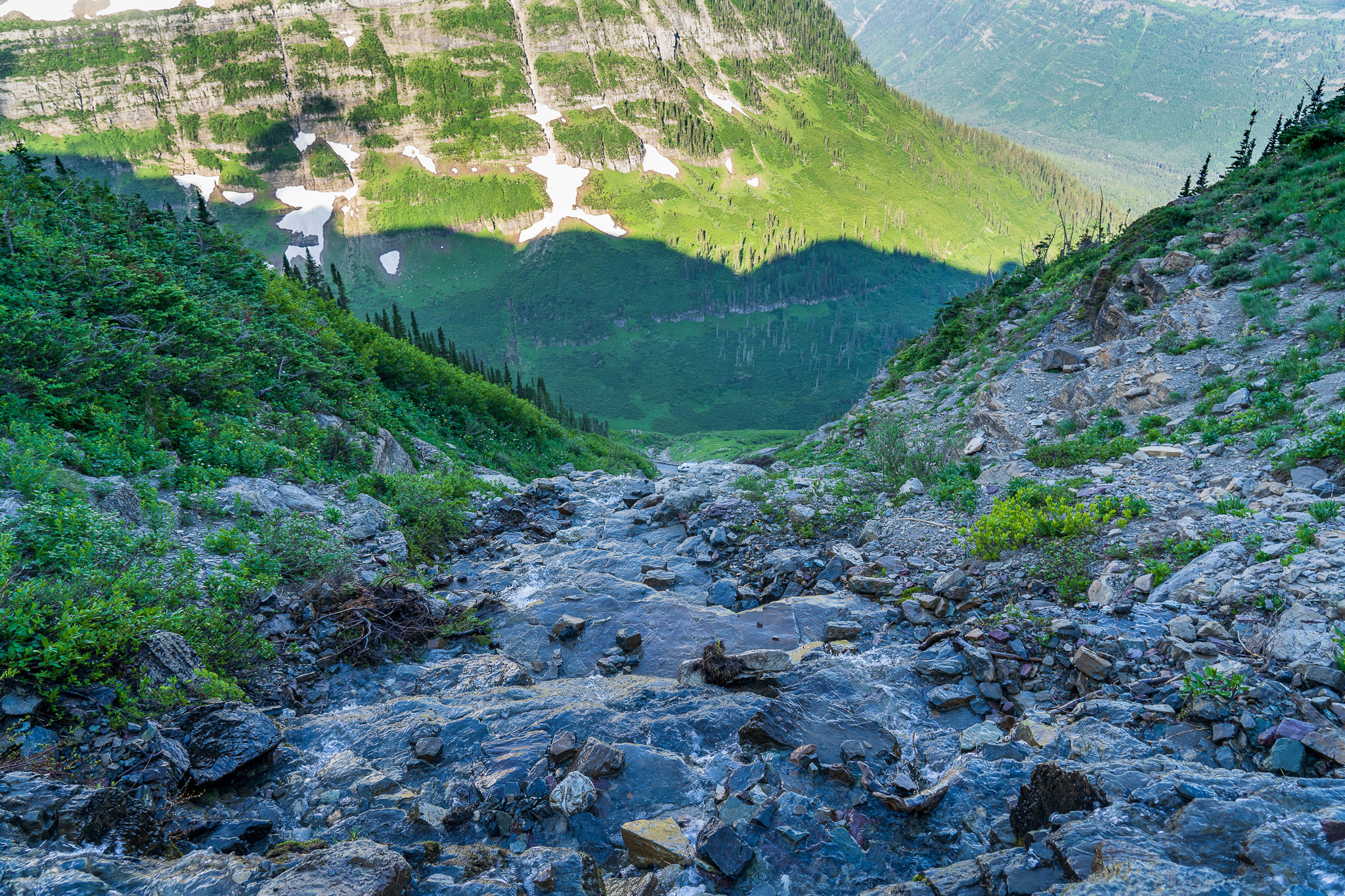
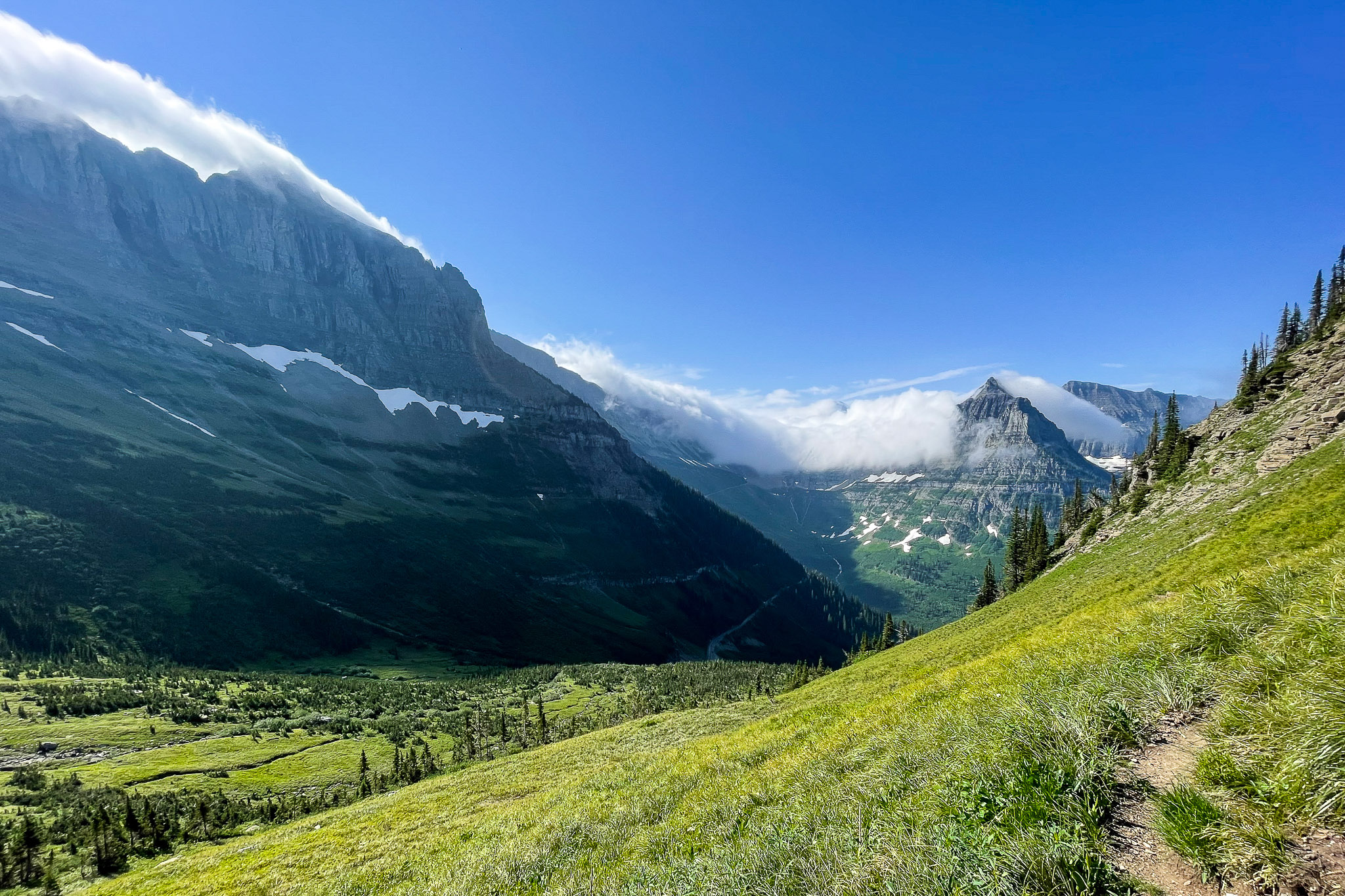
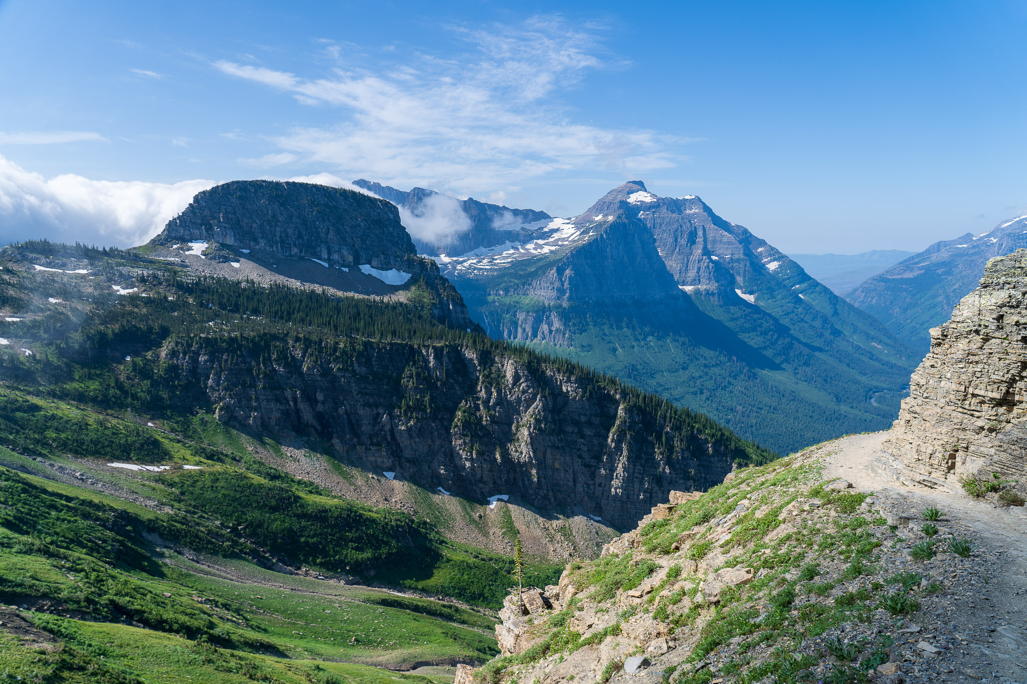
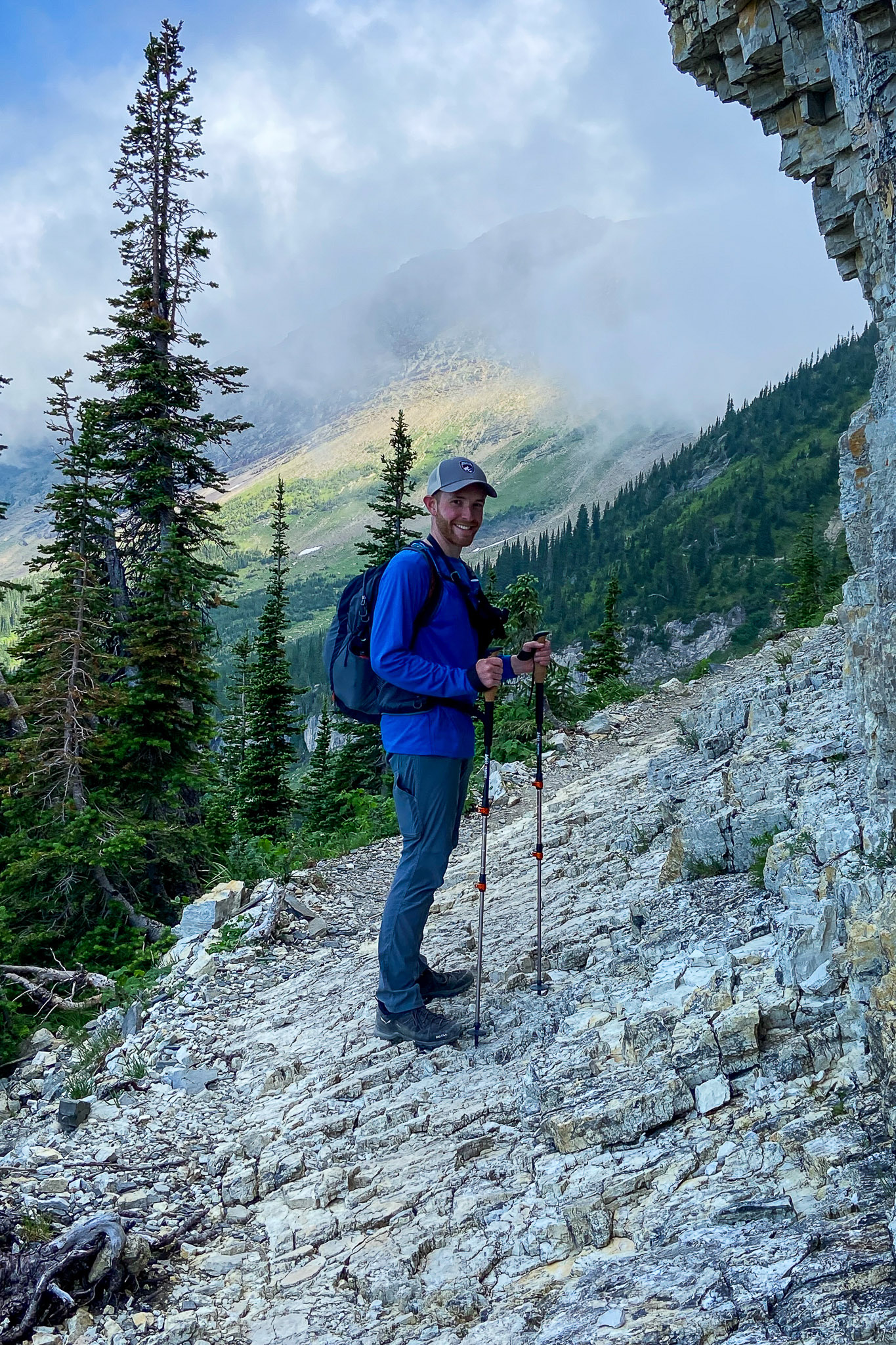
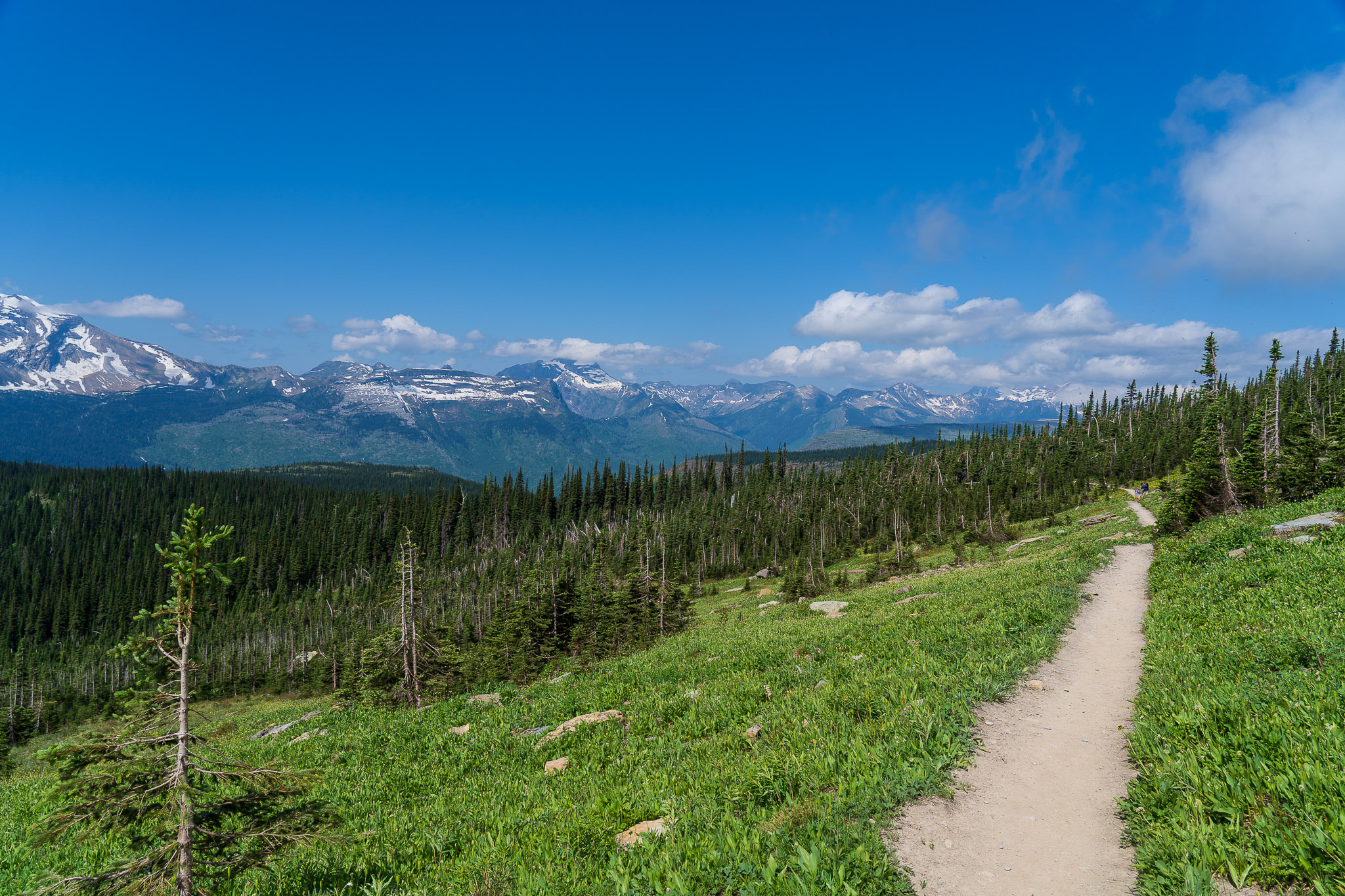
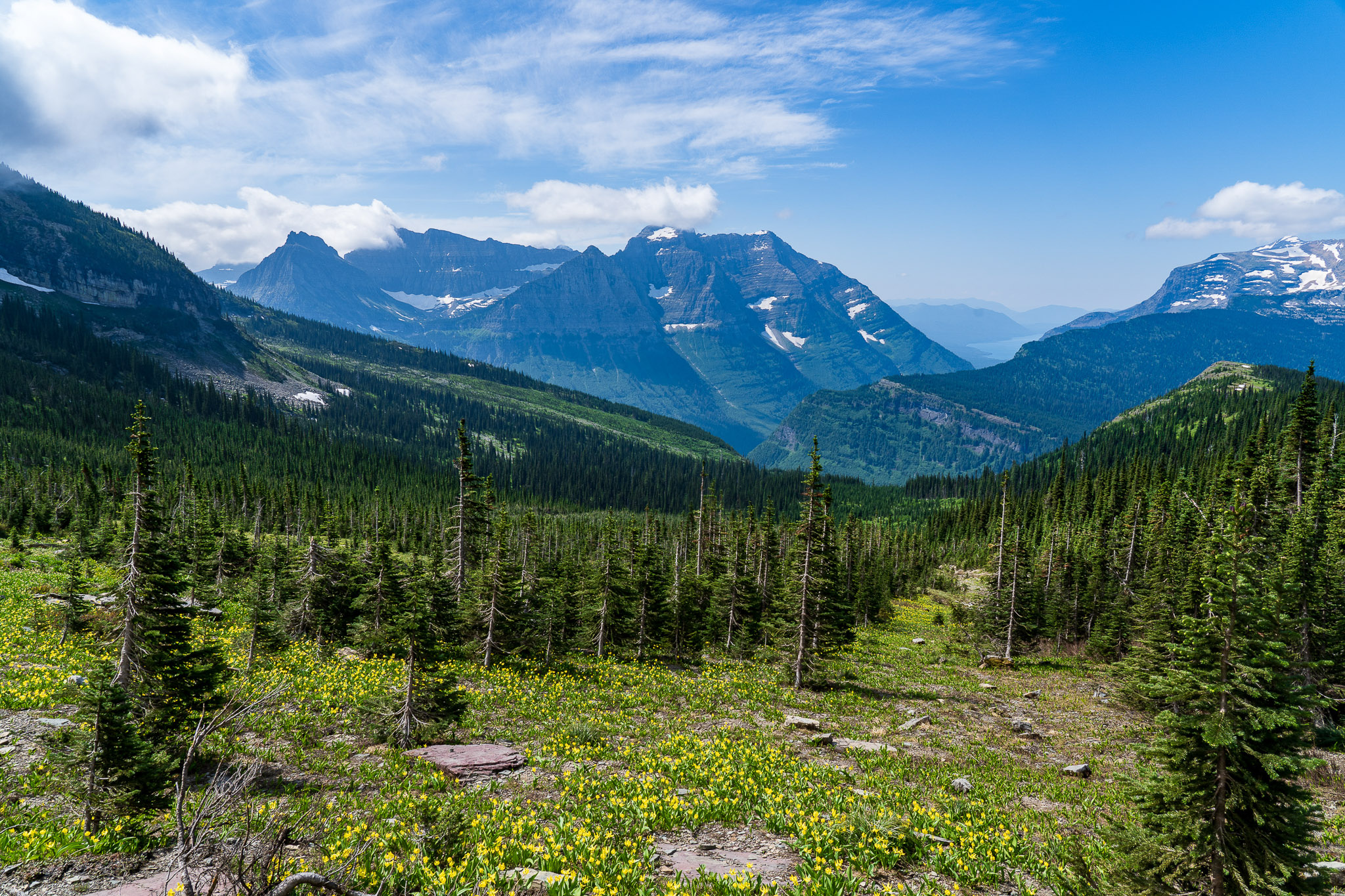
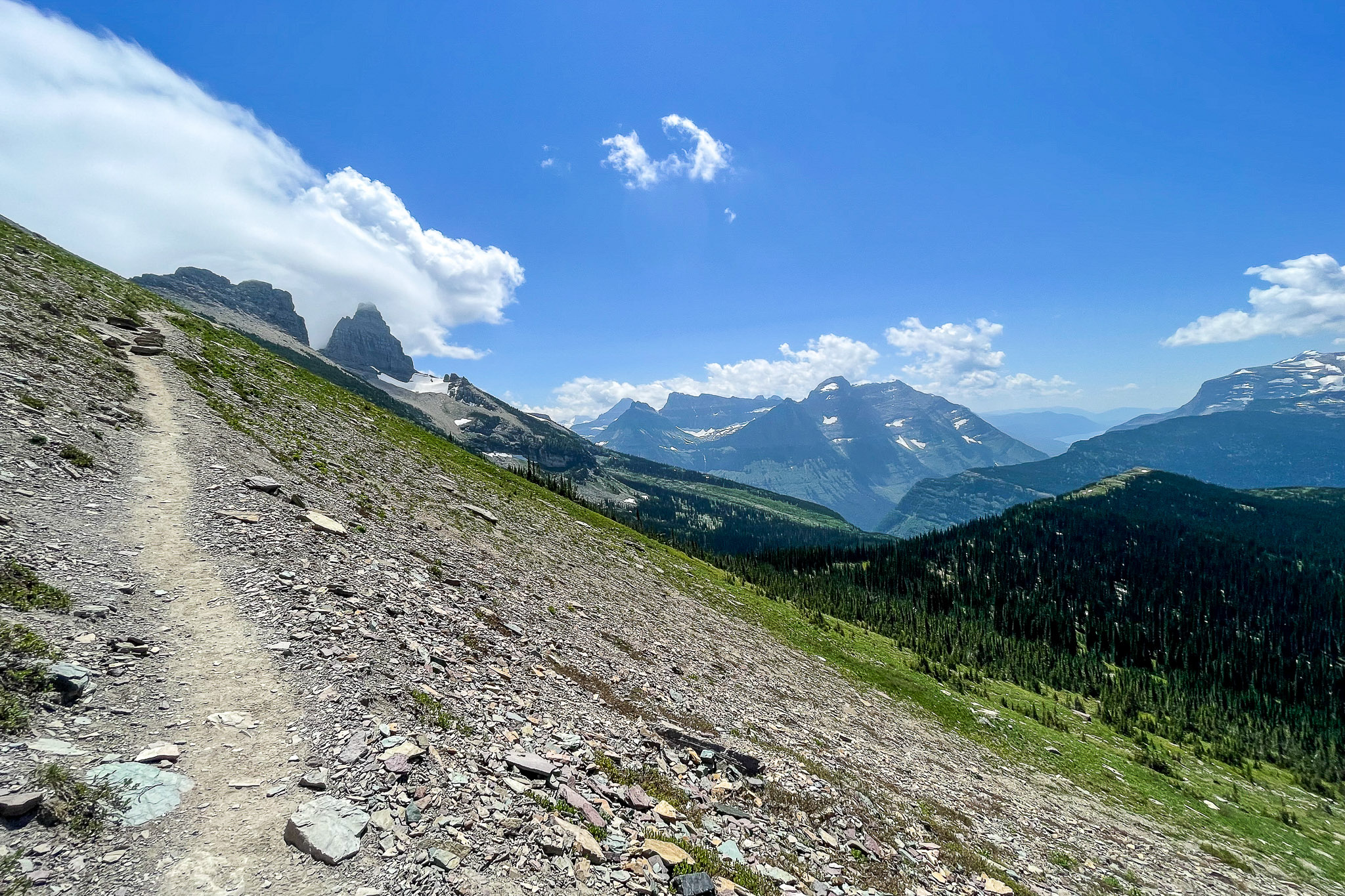
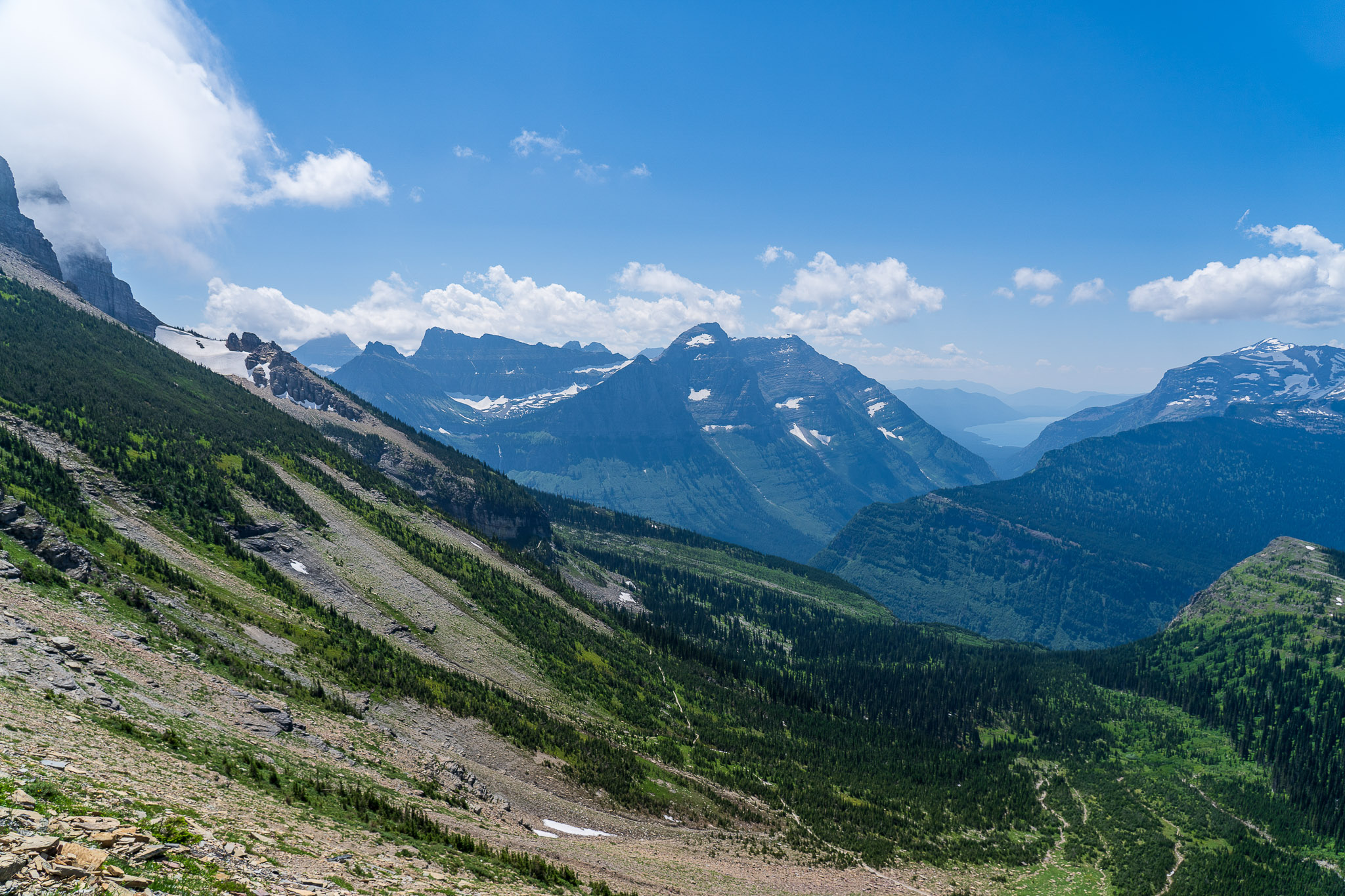
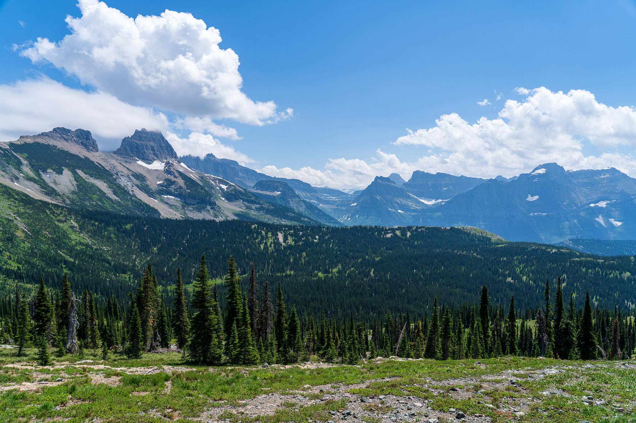
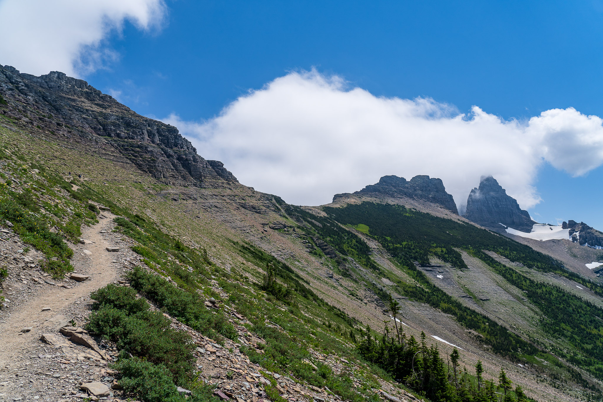
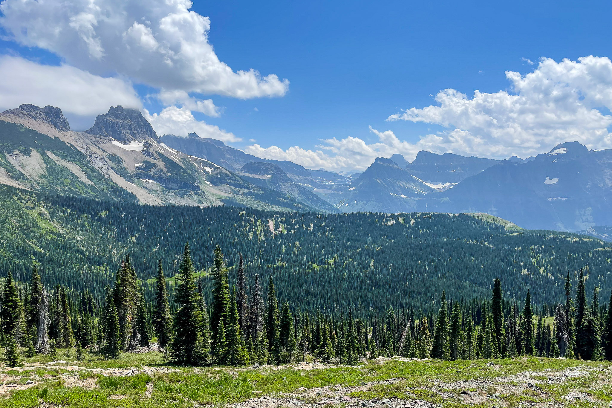
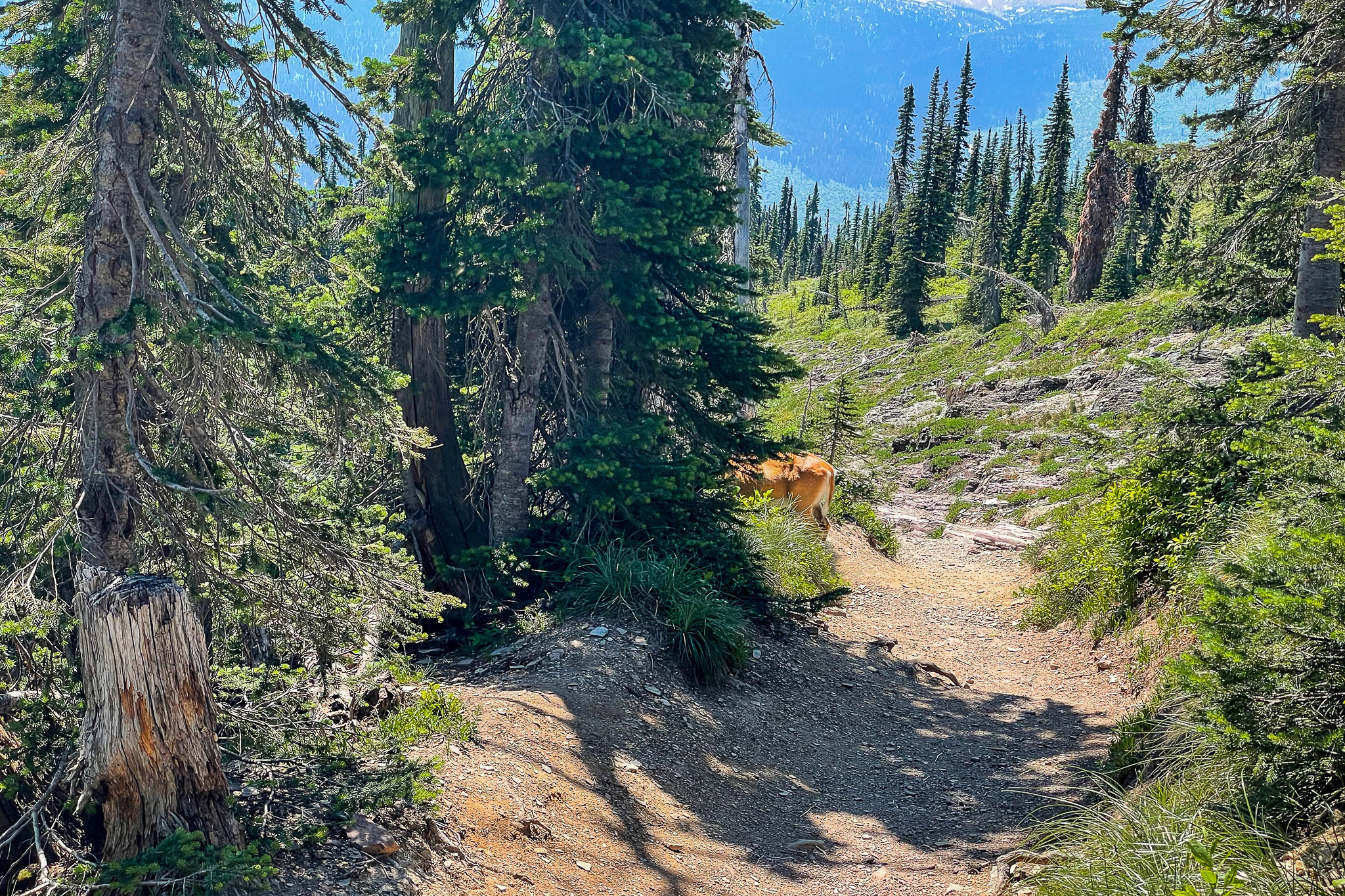
Heading north and west, the first section of the Highline Trail follows the Going to the Sun Road. The trail is carved into solid rock, high above the road. Every summer, park staff attach garden hoses as handrails. A lot of the comments I’d read online said it’s not a trail for acrophobes. I’m generally terrified of heights, especially if I don’t feel stable, but I had no problem with this section of the trail. In most places, the path is at least 6-8 feet wide, so if you hug the rock, there’s no reason to feel unsafe or unstable.
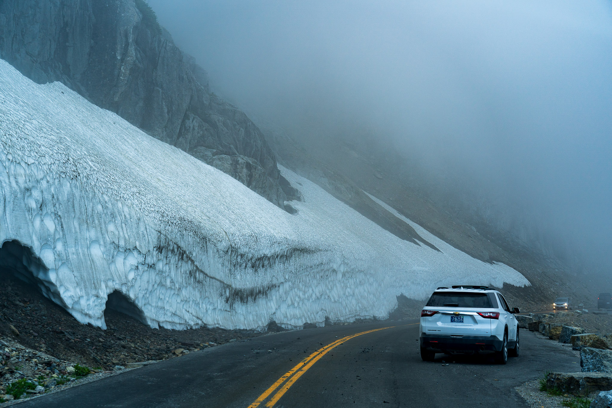
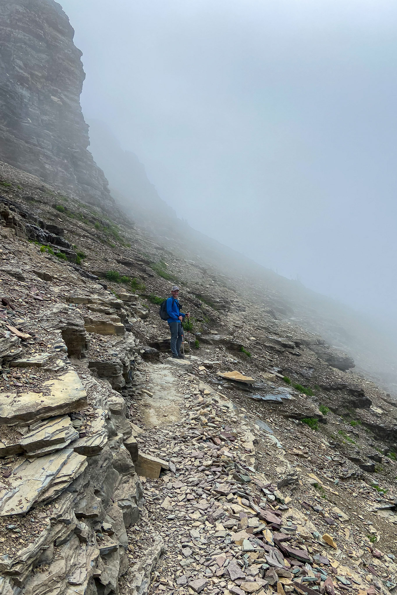
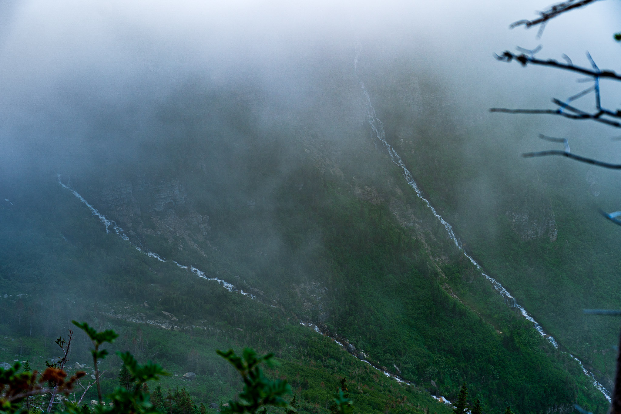
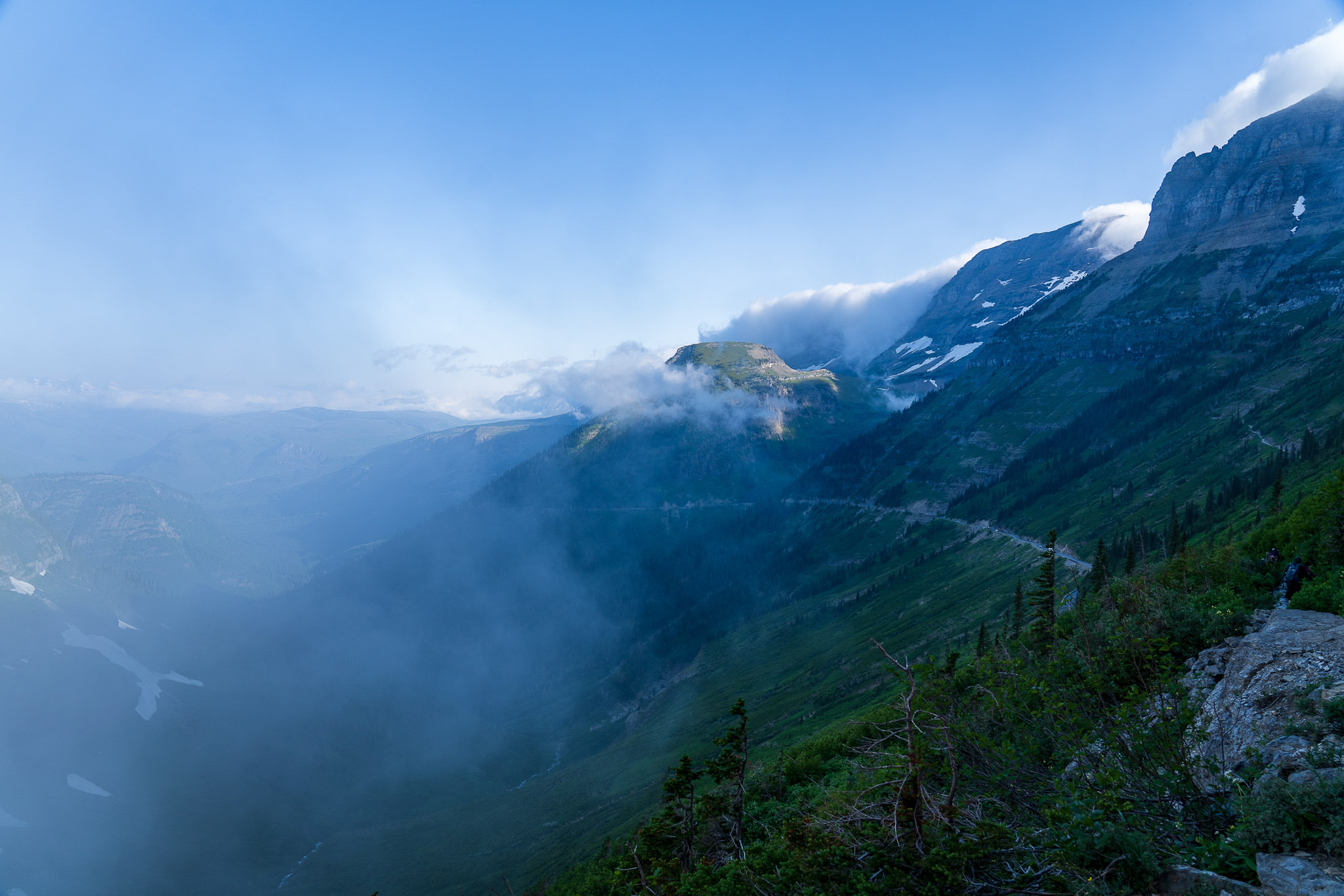
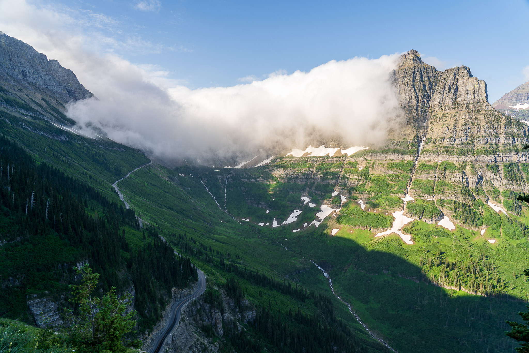
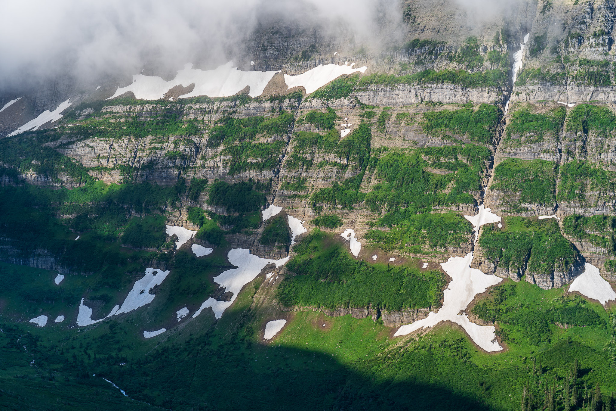
For the first half mile or so, we were completely surrounded by fog, and it was quite cold and windy. I wore long pants and sleeves because I’d been very badly sunburned yesterday, and I was glad to have the additional warmth. Soon, the fog started to burn off and the clouds lifted, and we had our first glimpses of Mount Oberlin and the dozens of waterfalls that pour into the valley below.
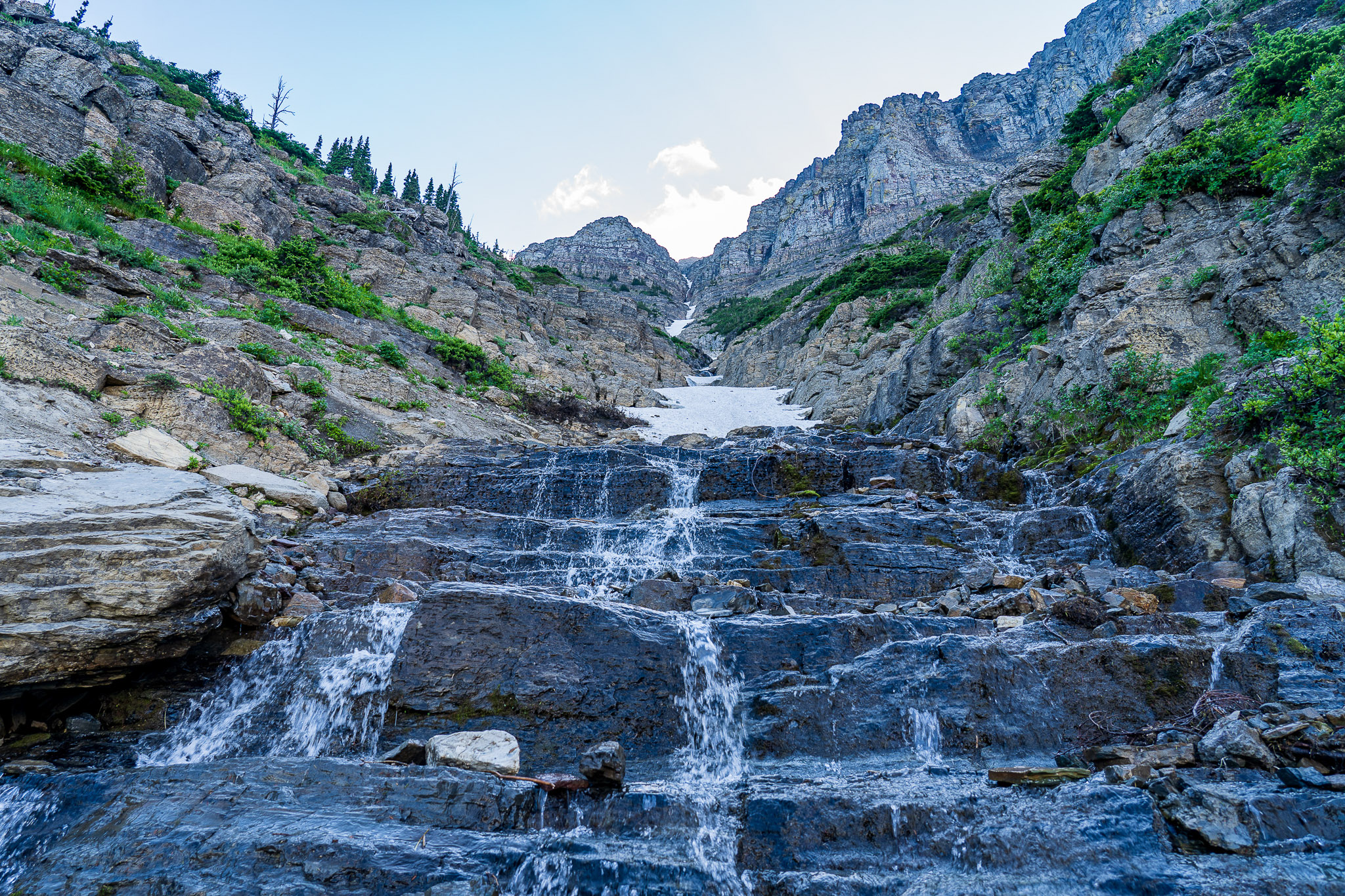
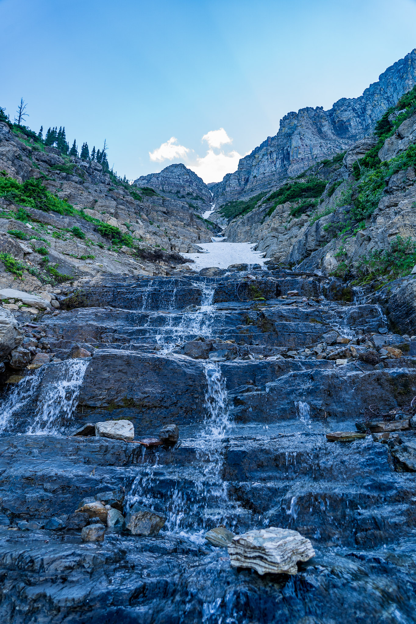
In the section of the trail nearest Logan Pass, we had to walk through a bit of snow and ice, but nothing too severe. Often, we were hiking through waterfalls. Earlier in the year, when the snow melt and glacier runoff is stronger, I imagine we’d have gotten pretty wet. Already, we were moving enough that the splashing drops of cool water were refreshing.
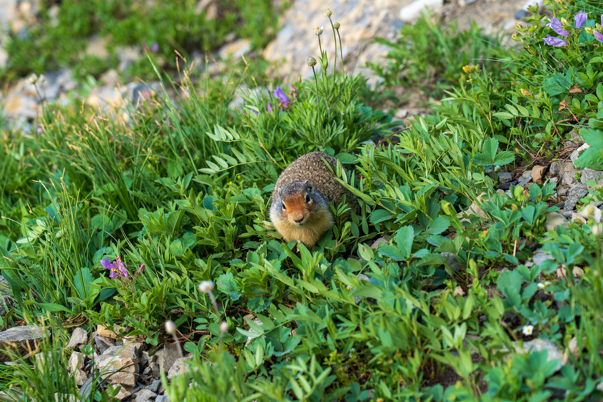
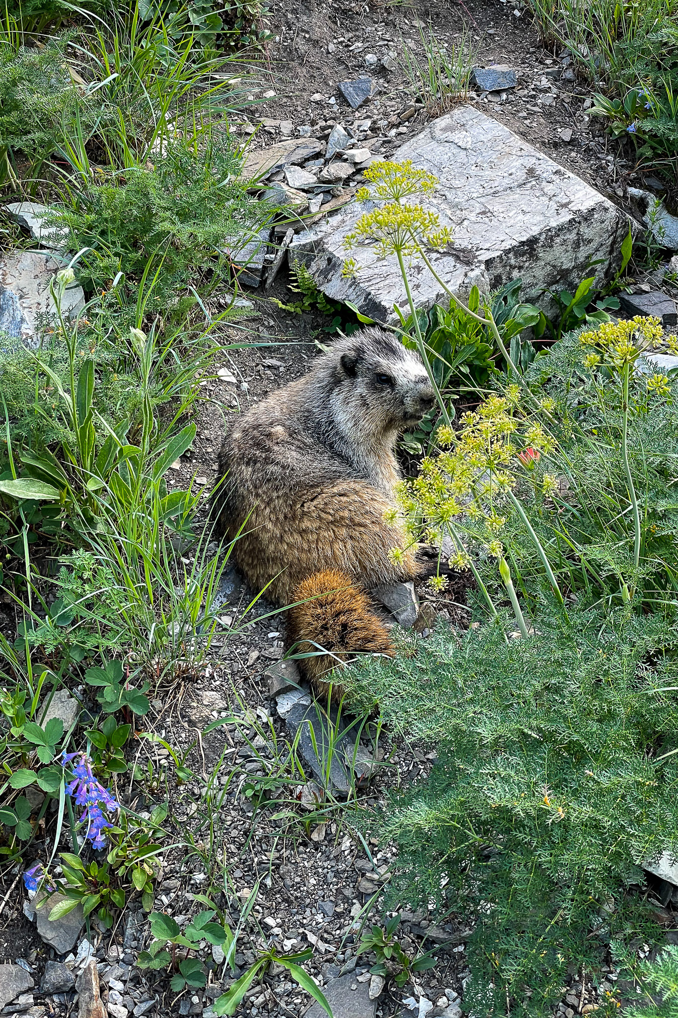
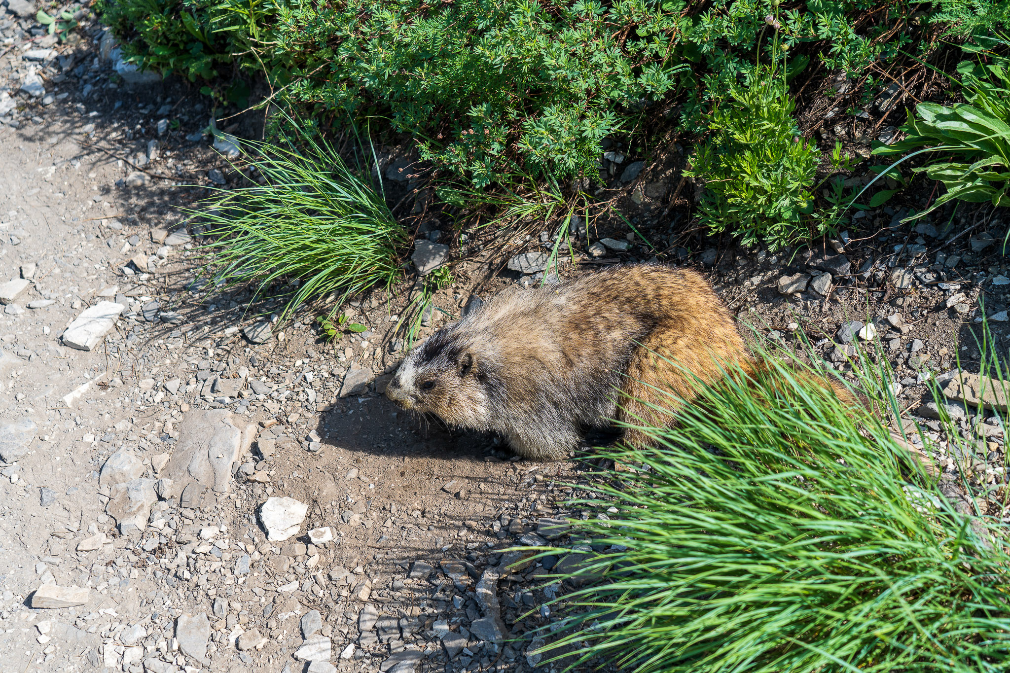
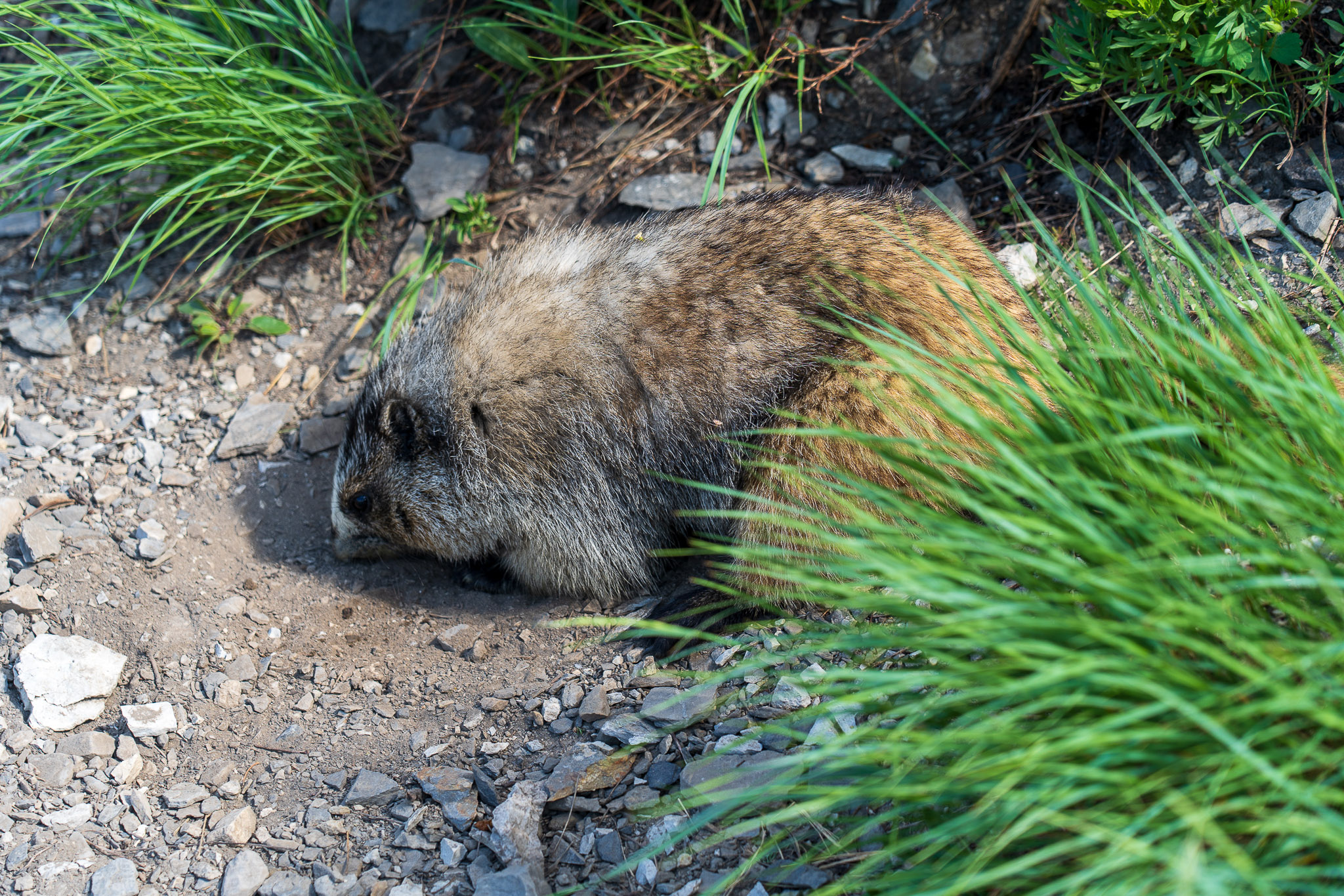
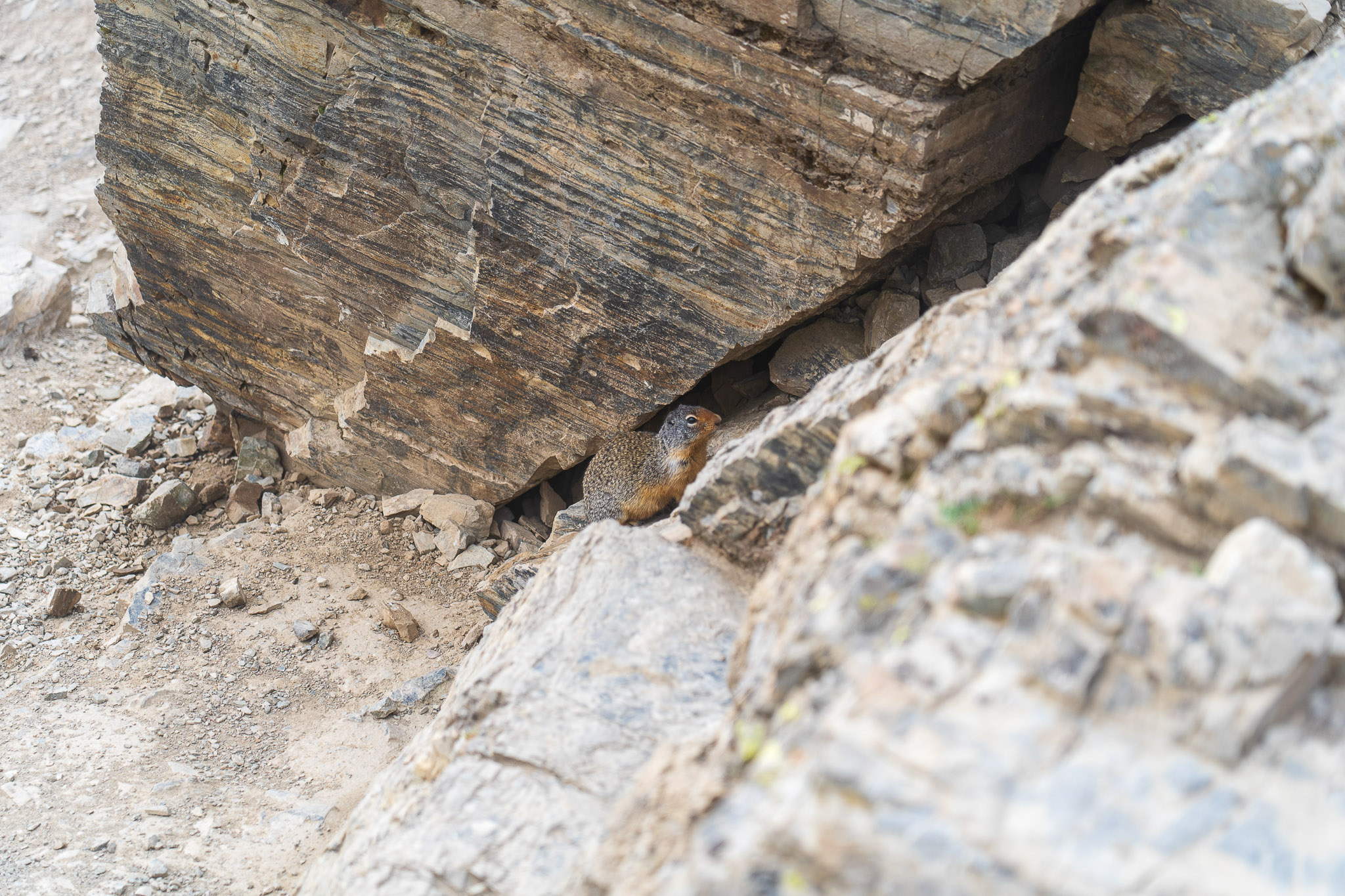
We didn’t see much large wildlife on the trail, but we did see some smaller creatures. There were plenty of hoary marmots (pictures later on), chipmunks, and squirrels, and several interesting birds too. I believe we also saw a pika or two in the alpine sections of the trail.
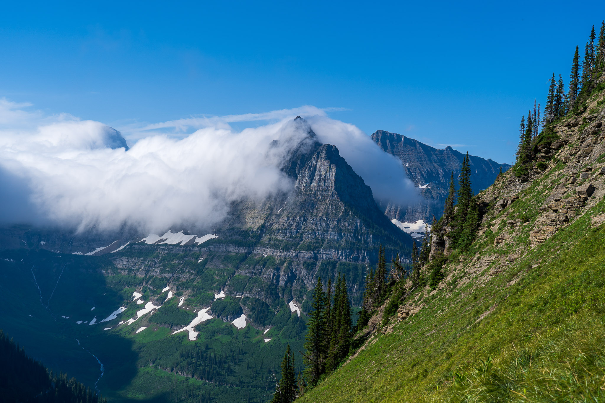
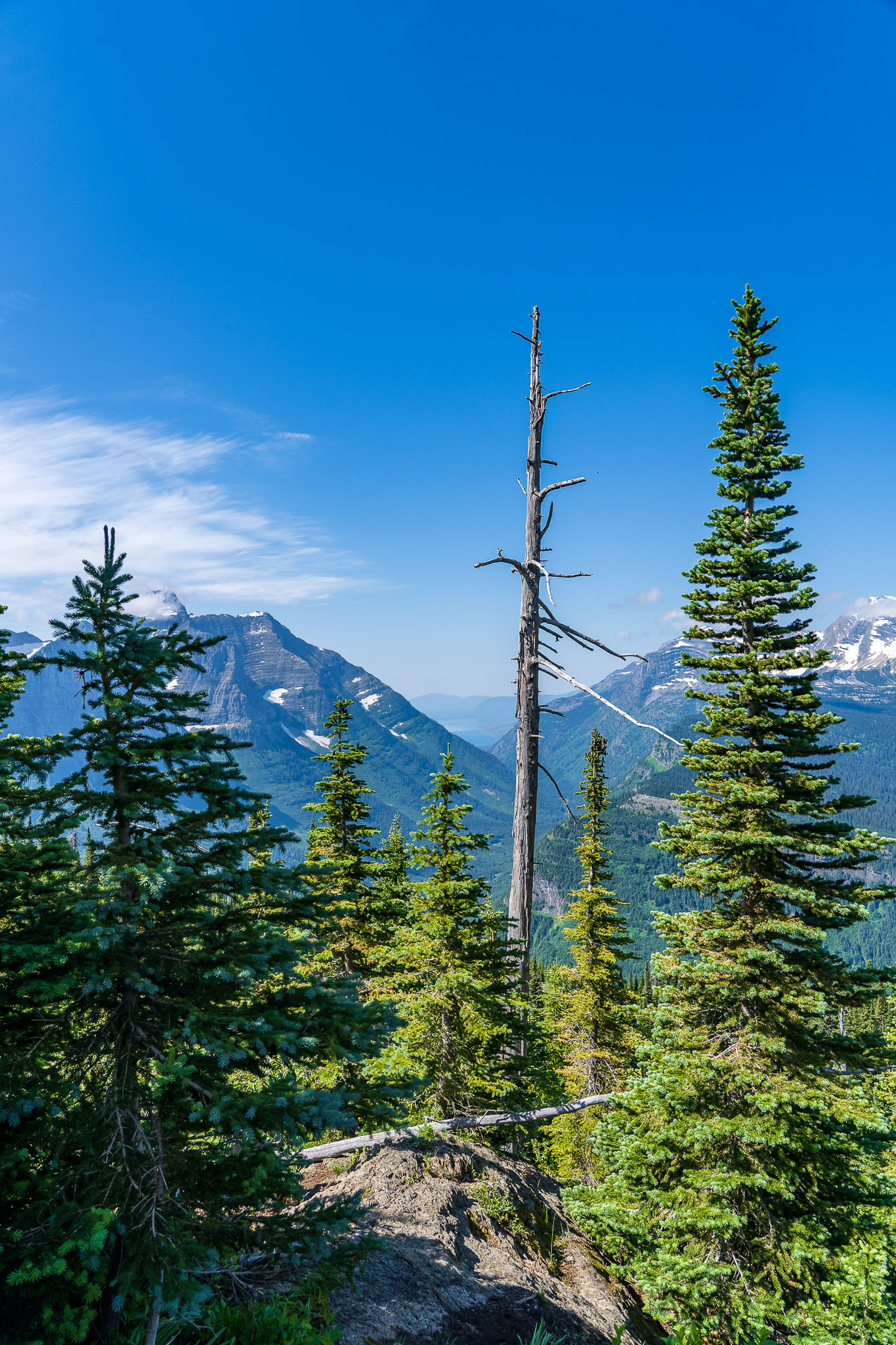
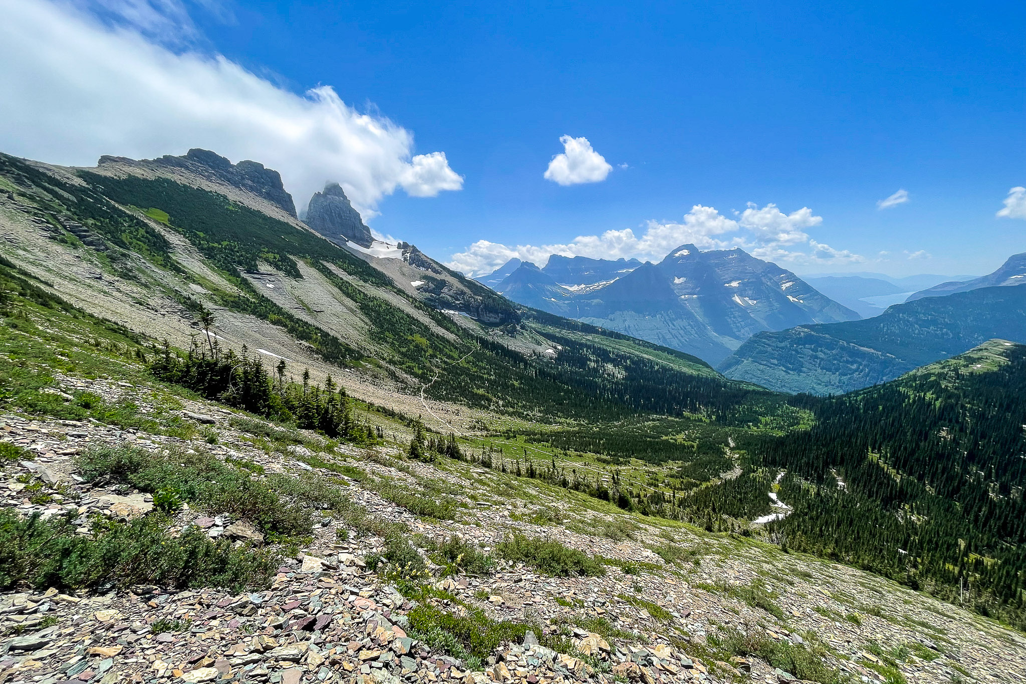
Finally, the clouds were mostly gone, and we had our first clear views of the surrounding area. It was a breathtaking sight to behold.
Meanwhile, Off the Mountain...
While we hiked, Mom and Dad drove over to Whitefish to find some breakfast, stopping at “Big Bend” (and a few other places) on the west side of the Going to the Sun Road to take some pictures and enjoy the views. They eventually ended up eating breakfast at Montana Coffee Traders in Columbia Falls, then slowly working their way back to our rendezvous point.
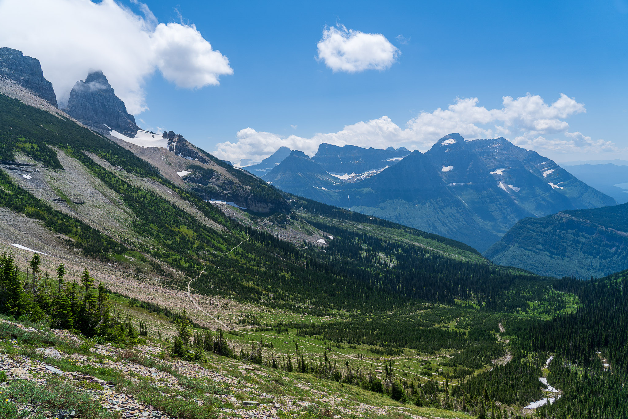
Highline Trail - Haystack Pass
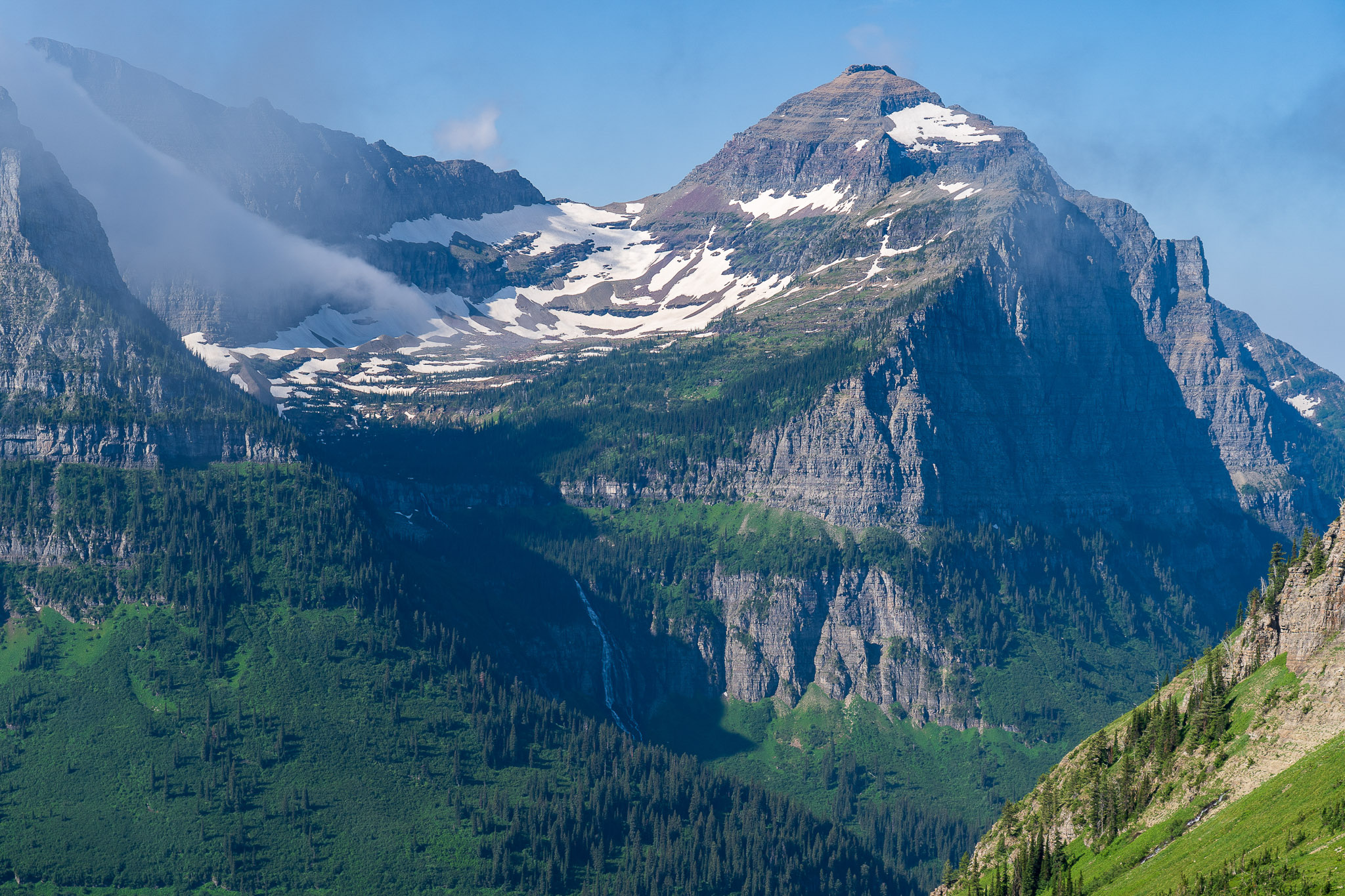
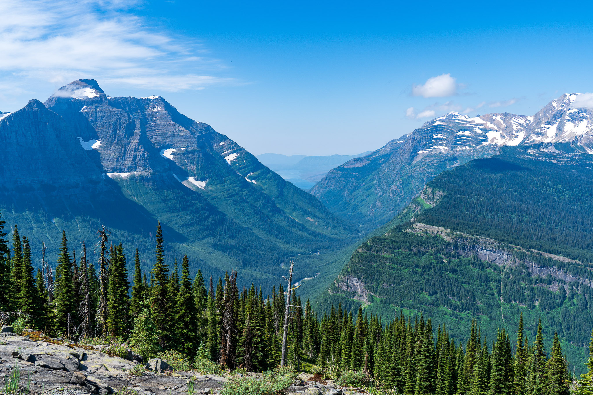
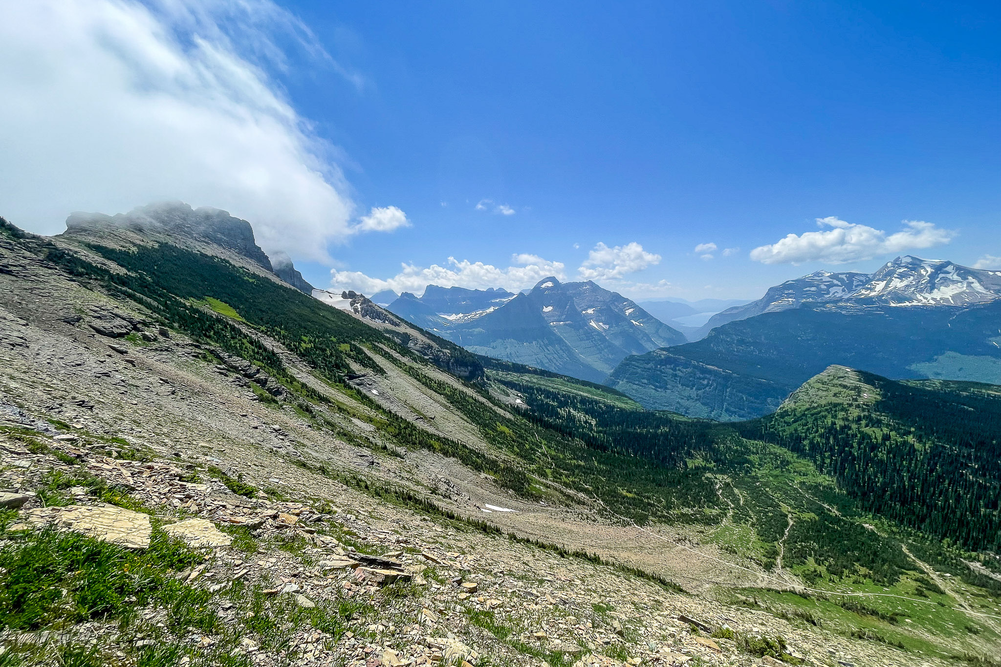
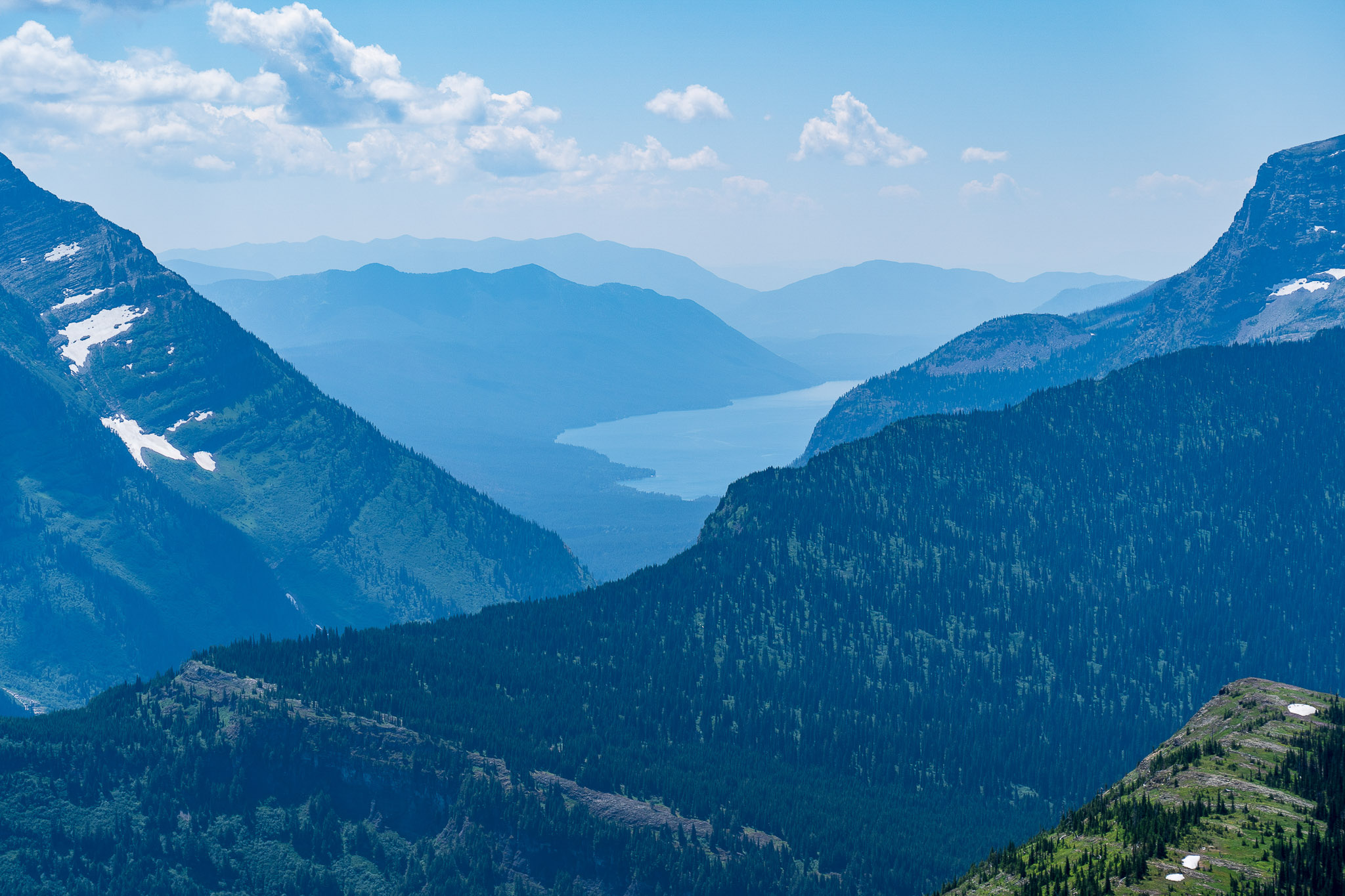
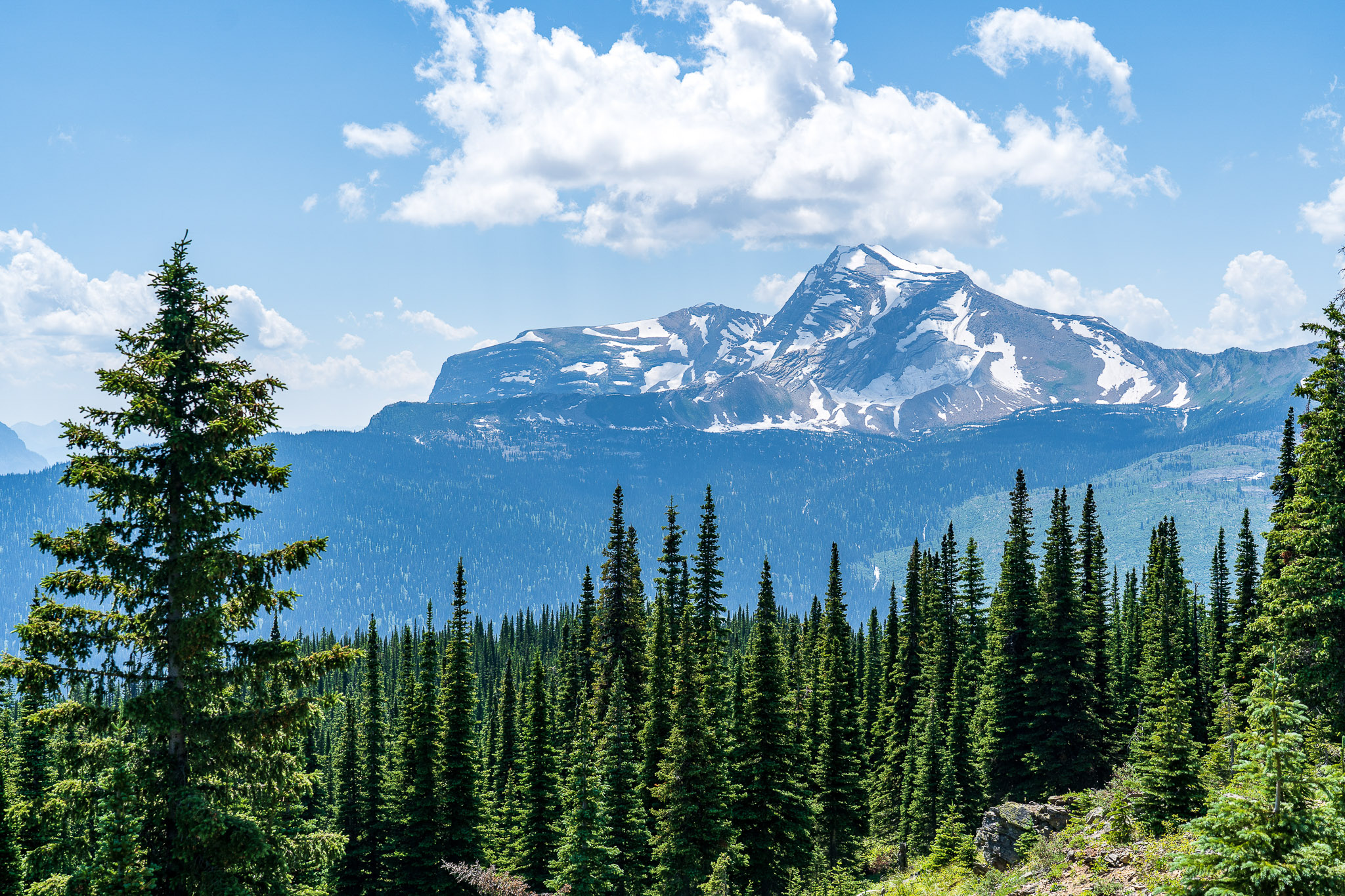
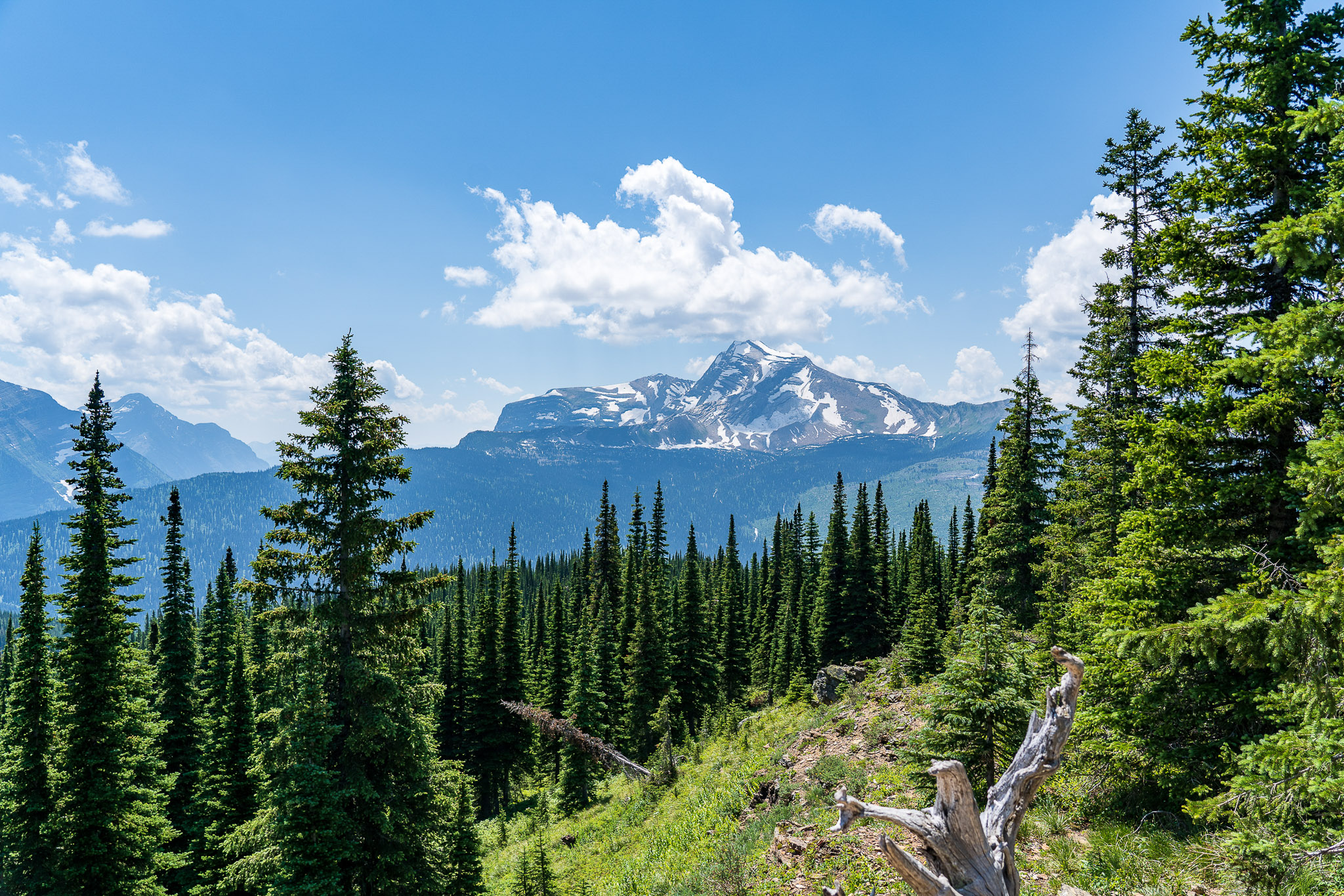
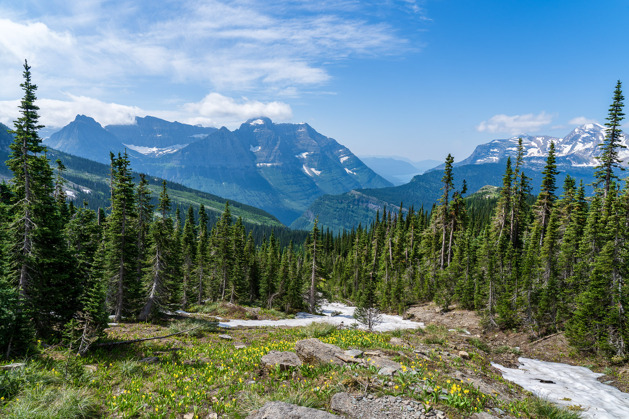
The trail climbed gently towards Haystack Pass. This is really the only “up” section of the trail, which climbs less than 800 feet in one giant switchback. The views continued to impress. We saw our first good view of Heaven’s Peak (8,848′), and could see back down the valley all the way to Lake McDonald.
At the pass, we saw a multitude of hoary marmots and other ground mammals.
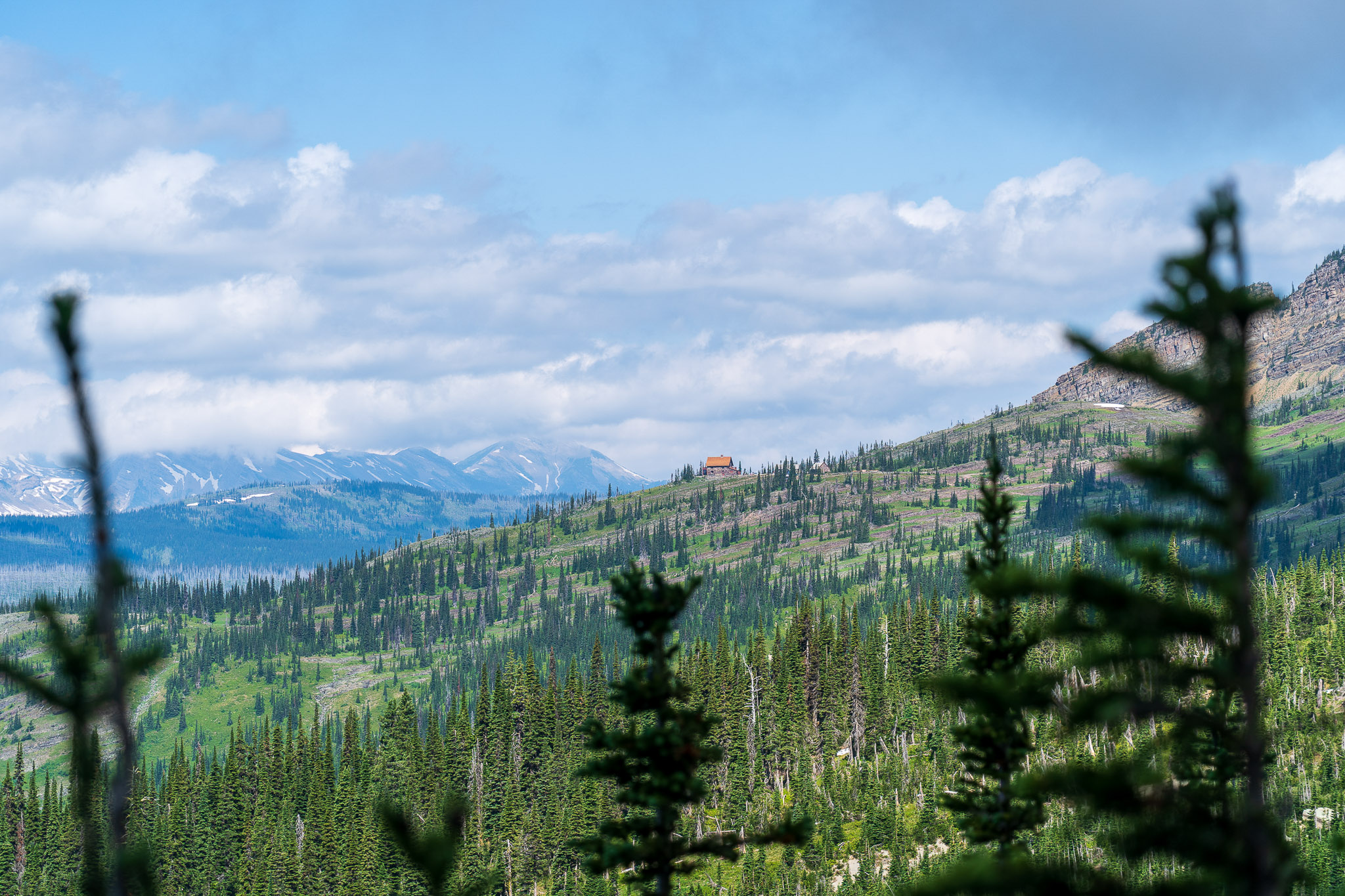
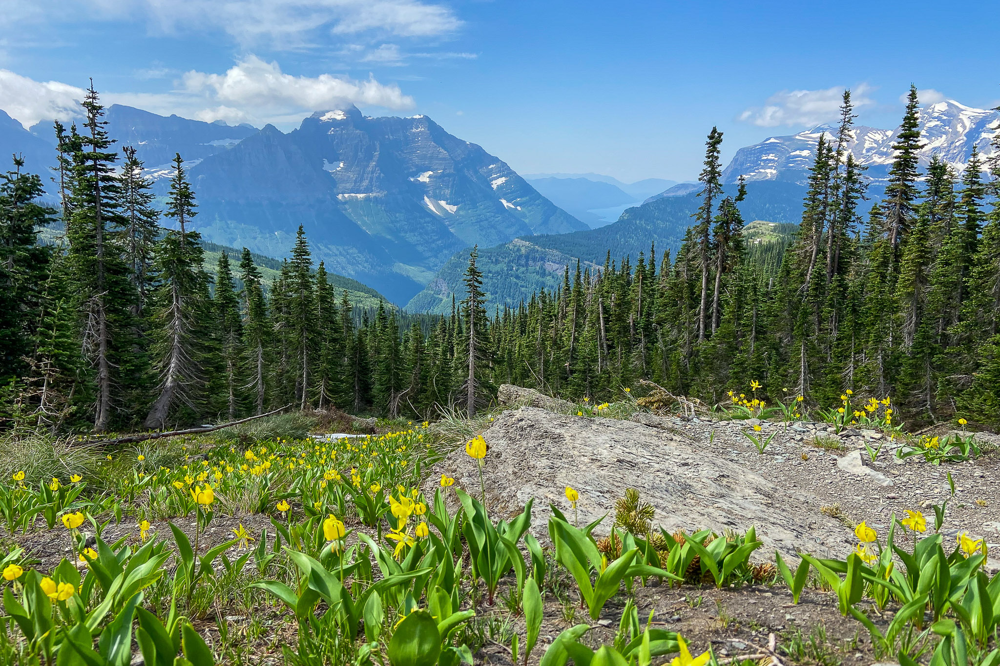
Several miles away, we could also see the Granite Park Chalet. The wildflowers in this area were particularly beautiful. We took our time going through the pass, enjoying everything that surrounded us.
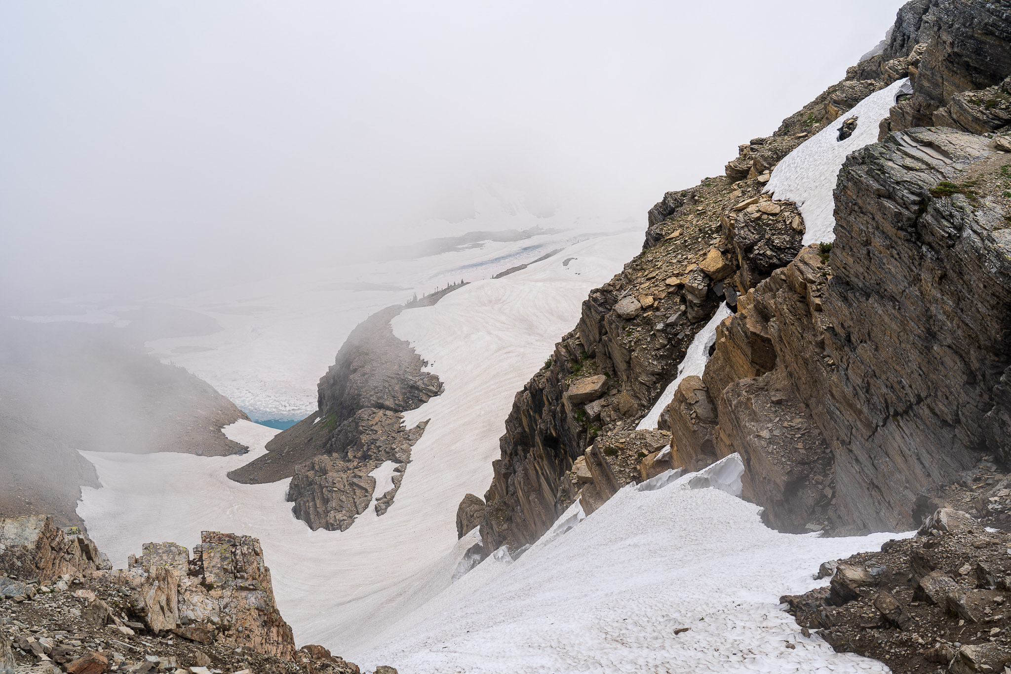
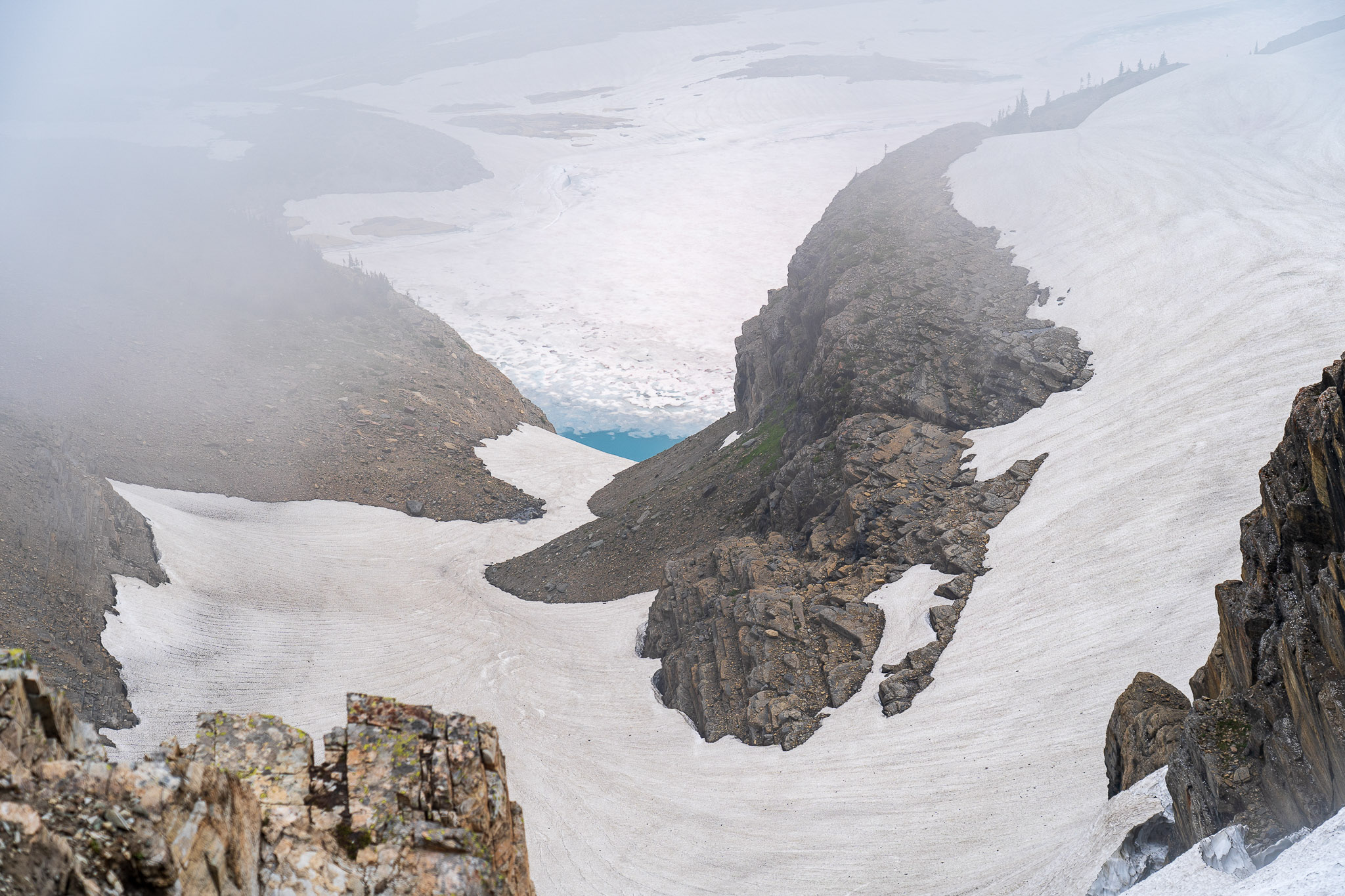
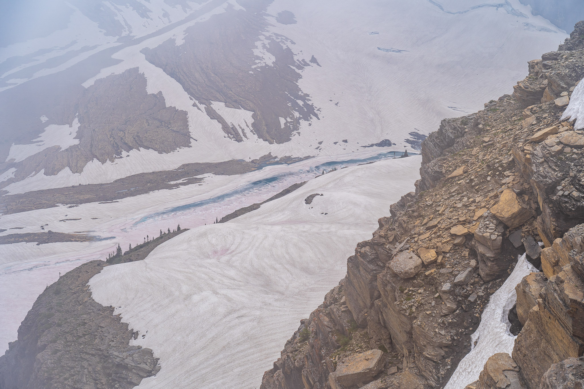
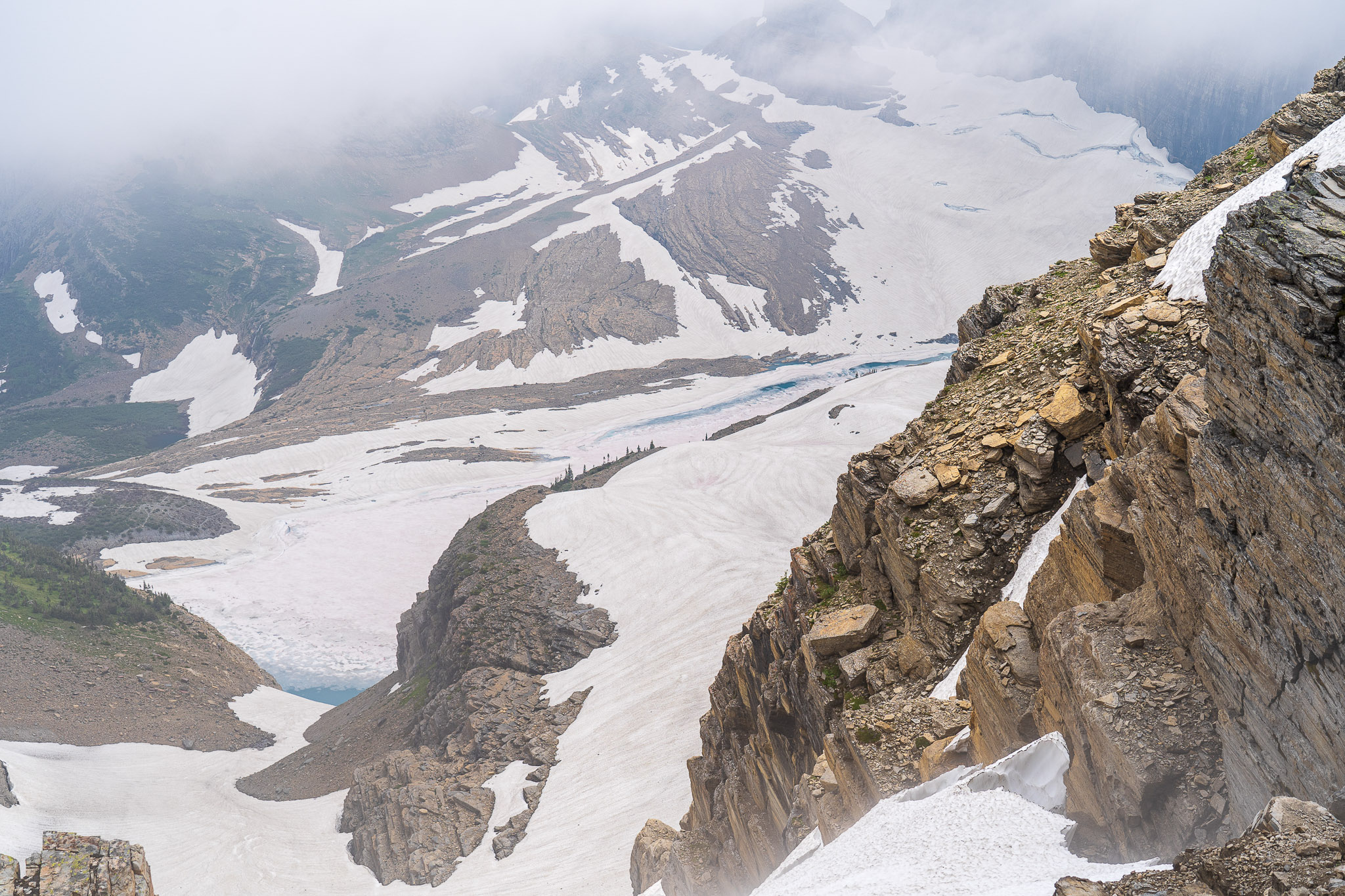
Garden Wall/Grinnell Glacier Overlook
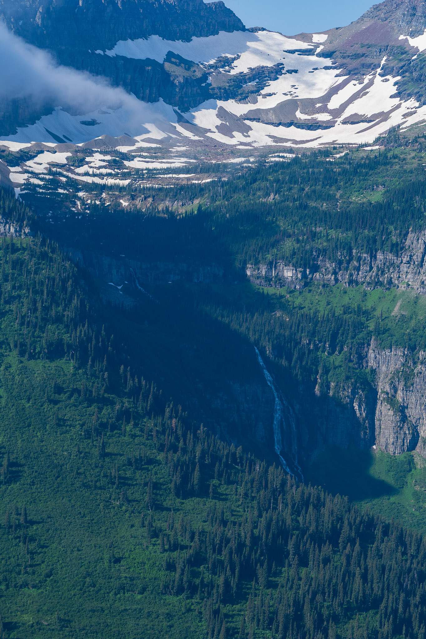
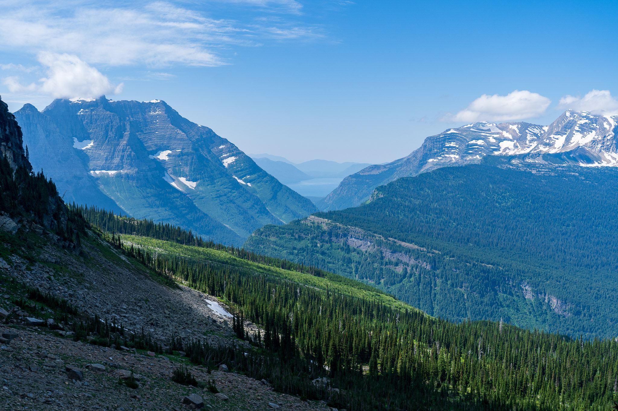
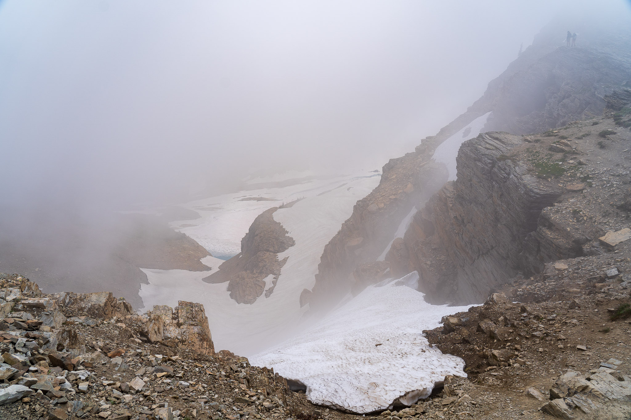
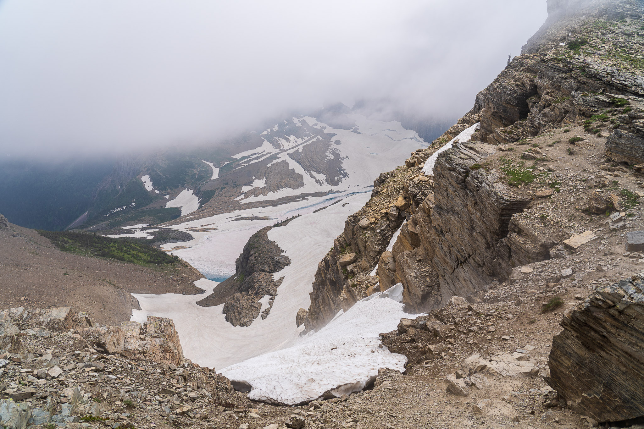
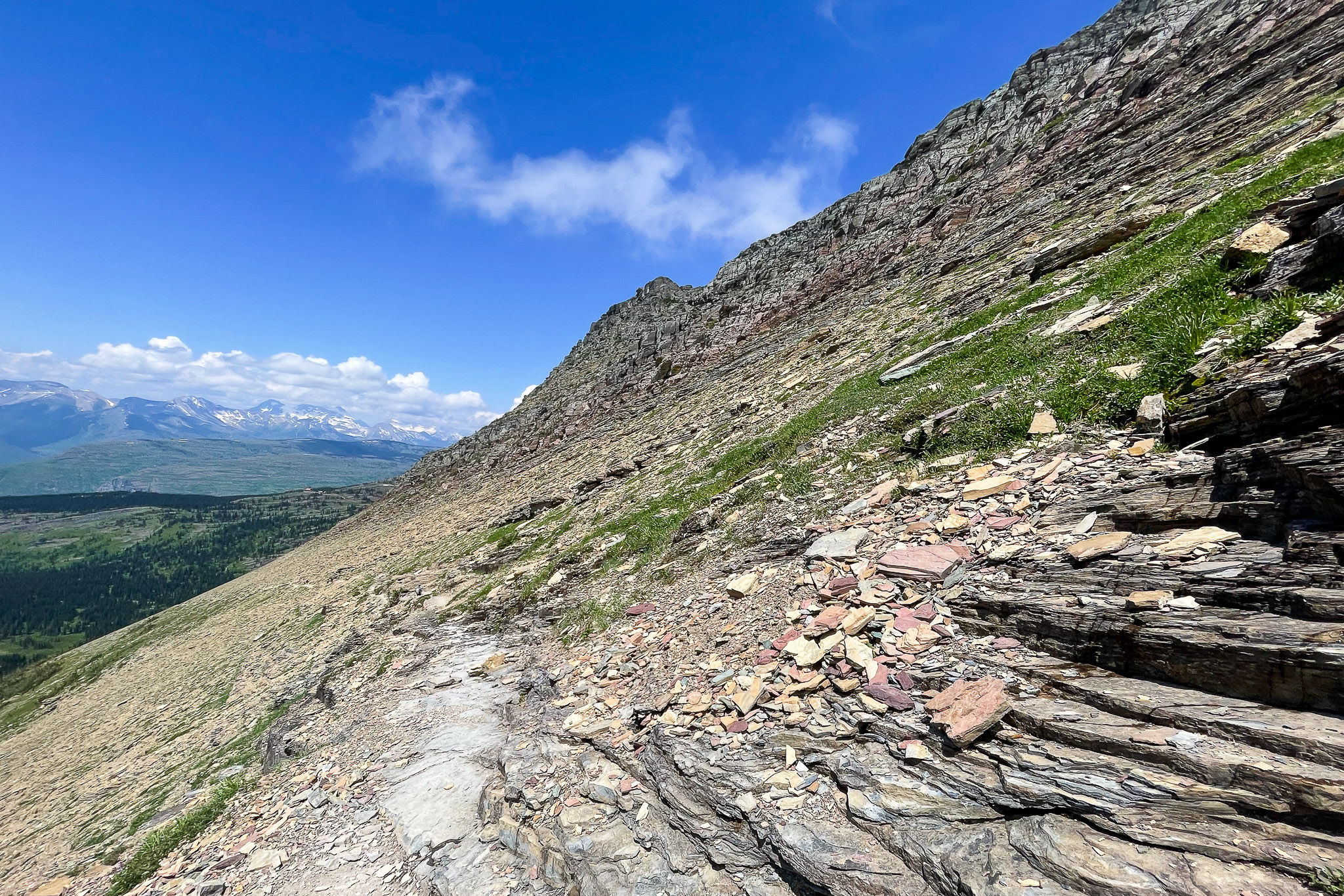
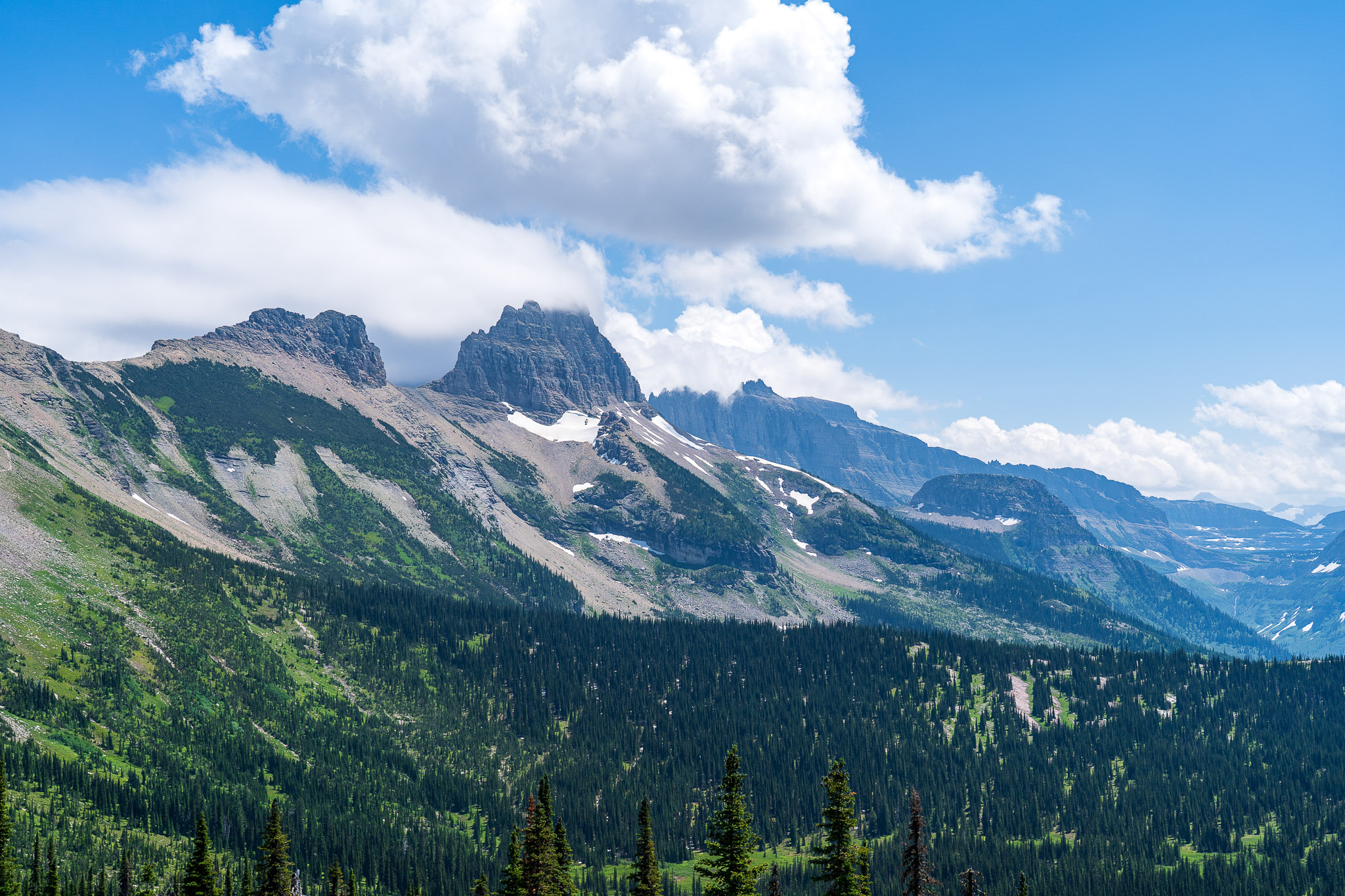
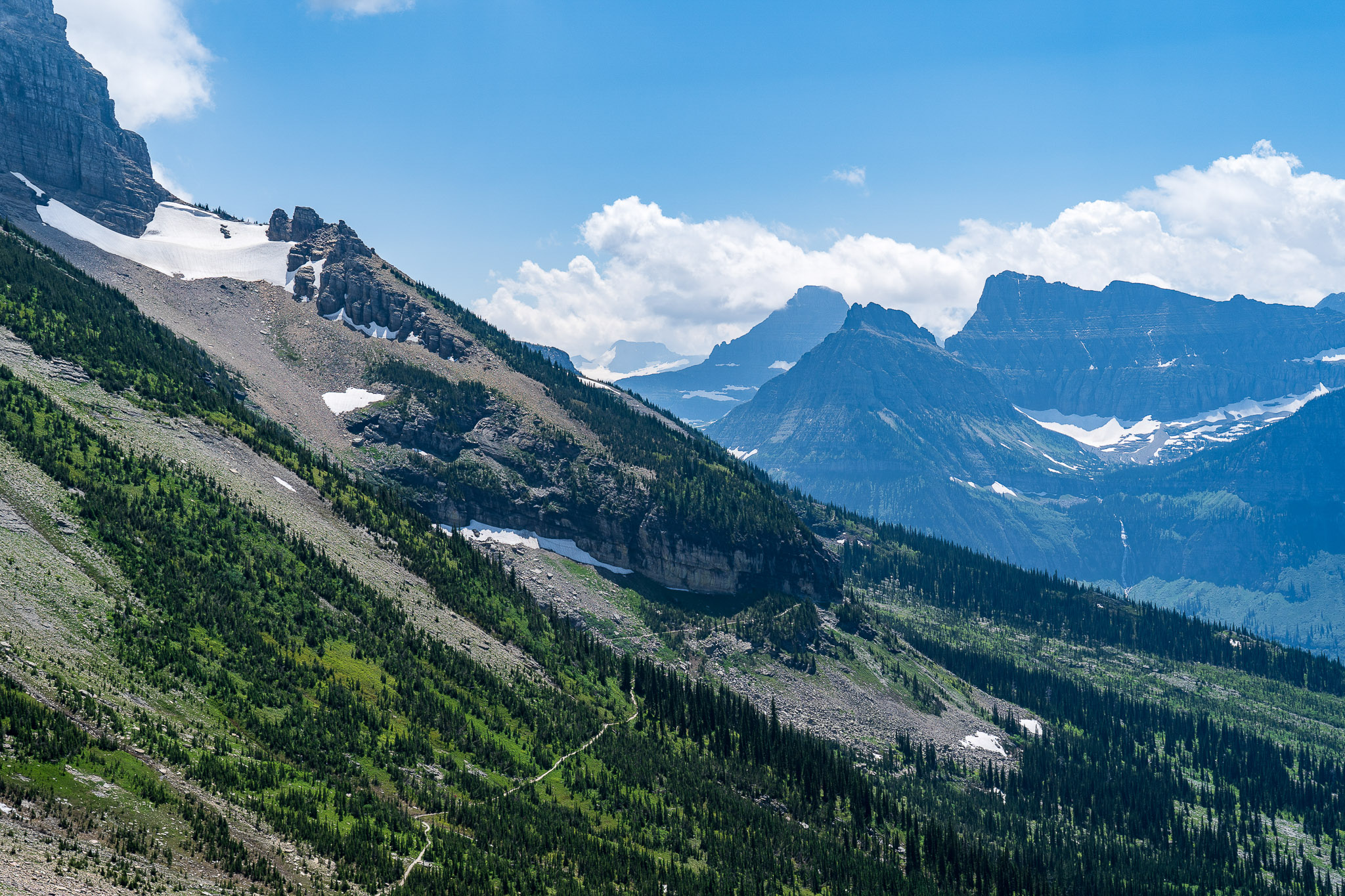
6.7 miles from our starting point at Logan Pass, there’s a small sign marked “Glacier Overlook”. This is officially the “Garden Wall Overlook” or “Grinnell Glacier Overlook”. An extremely steep trail ascends over 1,000′ in 0.6-0.8 miles to a U-shaped dip in the top of the Garden Wall. As a reminder, the Garden Wall is the Continental Divide, which we’ve been hiking along since early this morning. From the summit, one looks down upon the Salamander and Grinnell Glaciers, Upper Grinnell Lake and Mount Gould. A couple trails from the Many Glacier area go to the brink of the glacial lakes below.
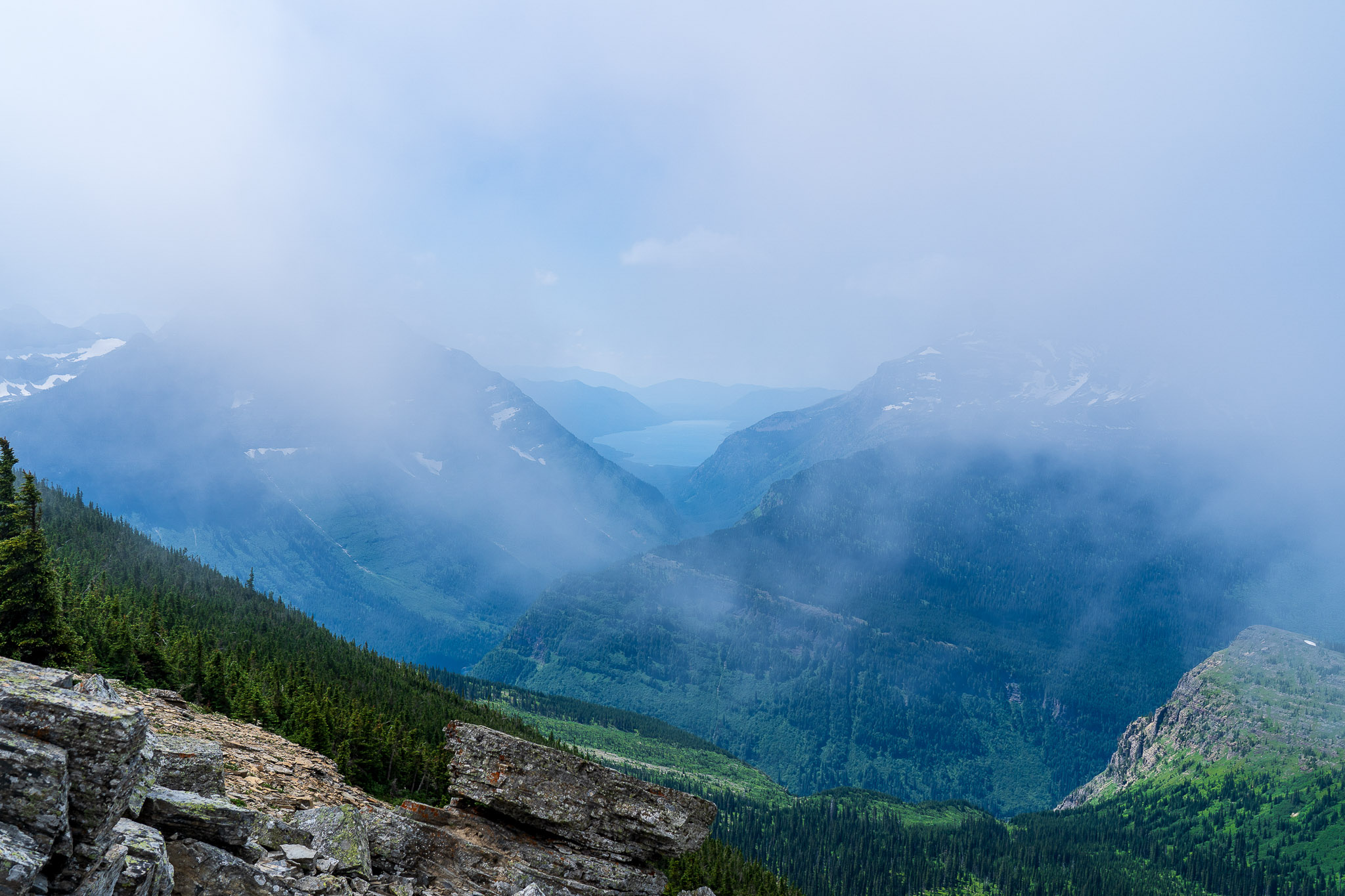
This part of the hike gave us an acute taste of the quickly changing alpine climate. On the main trail, it was around 80°F, but at the summit, where the wind crossed the Continental Divide, it was around 18-20°F with the wind chill (according to a tiny thermometer someone had strapped to their backpack). Fortunately, we were prepared with down layers and wind shells, and the cool didn’t feel nearly as bad because of the extreme climb we’d just finished.
Unfortunately, it was extremely cloudy at the top. After waiting around for at least 30 minutes, conditions thankfully improved, though marginally. We were only able to see glimpses of the lake and glaciers below, but what we saw was magnificent, even with poor visibility. Faith and I both agreed the climb up was worth it, even if the conditions weren’t ideal. I felt bad for some of the people who descended shortly before us…some of them said they’d been waiting for hours and hadn’t seen anything but clouds.
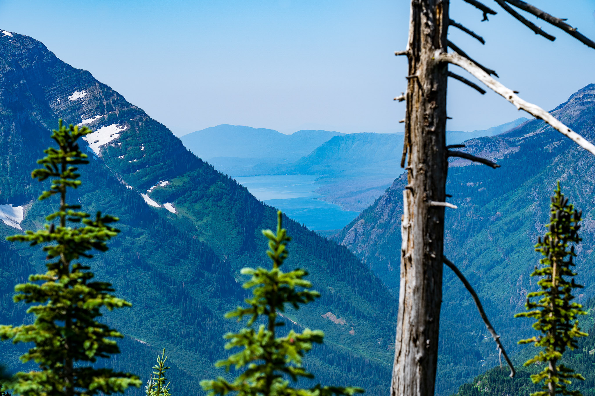
From this elevation, we could see Lake McDonald even more clearly. Viewing both sides of the Continental Divide and seeing their contrast was fascinating. The south side was much more green and lush, while the north face was almost completely covered in ice.
Highline Trail - Granite Park Chalet
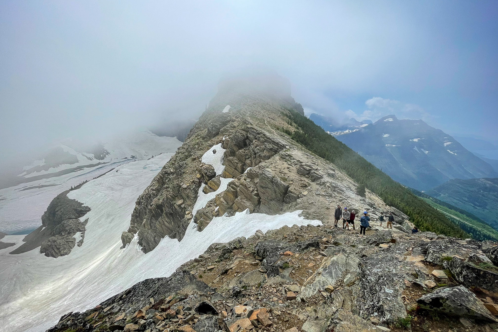
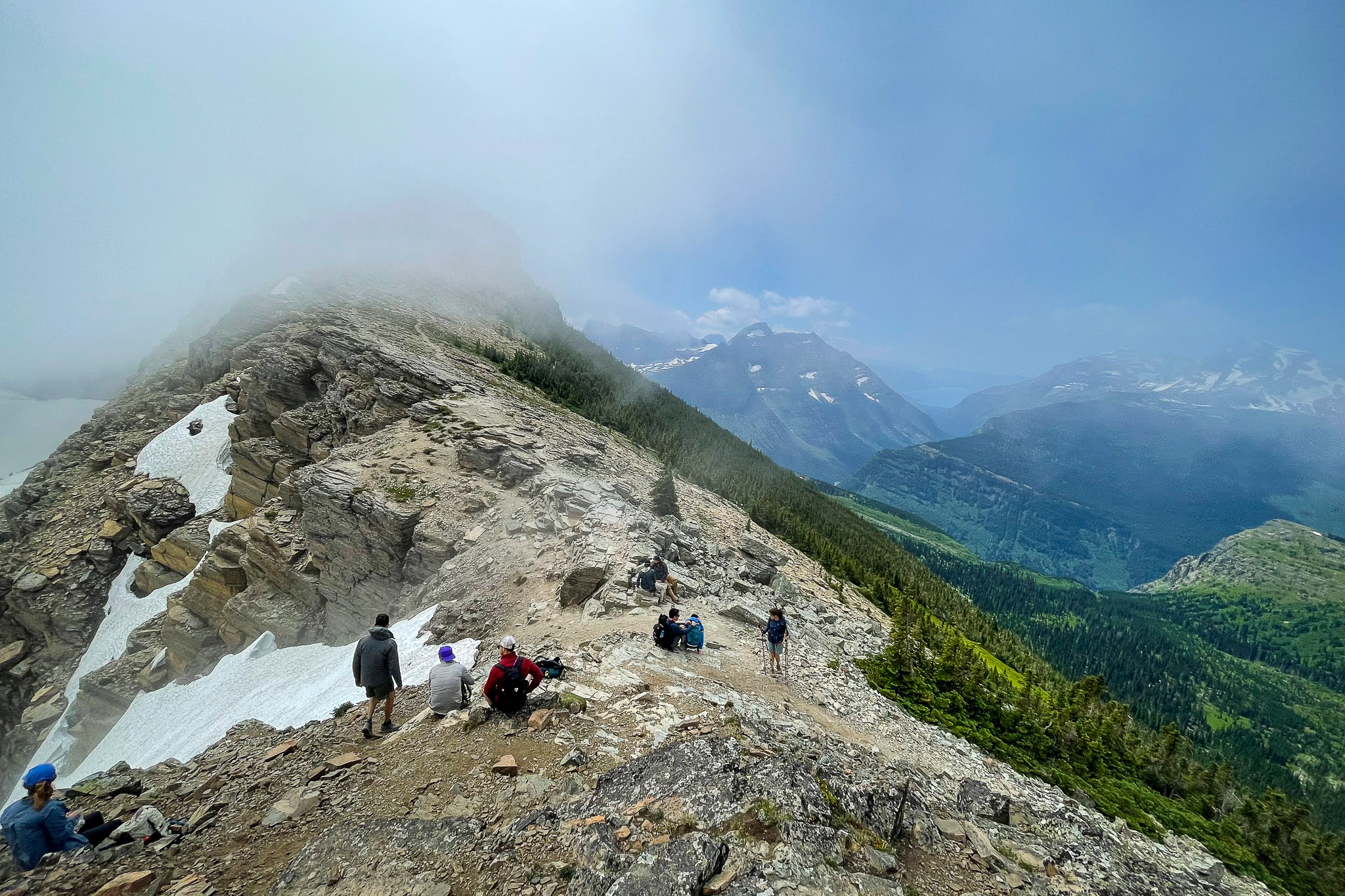
It took about as long to descend the Garden Wall as it did to climb it. In the photos below, you can see the U-shaped crest in the clouds on the left – that’s where we climbed. Far below, just below the green trees, you can see a line – that’s the Highline Trail where we started. In the distance, you can see the clear, blue waters of Lake McDonald.
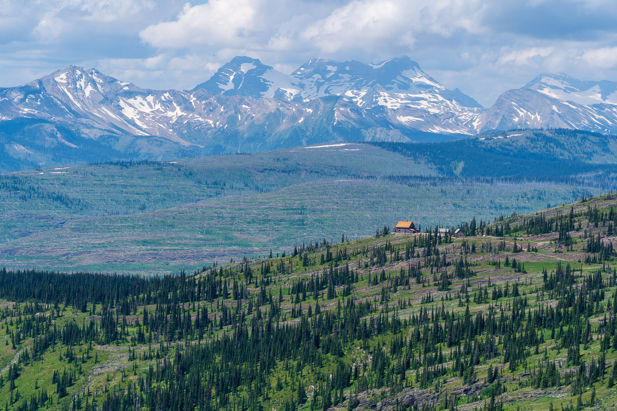
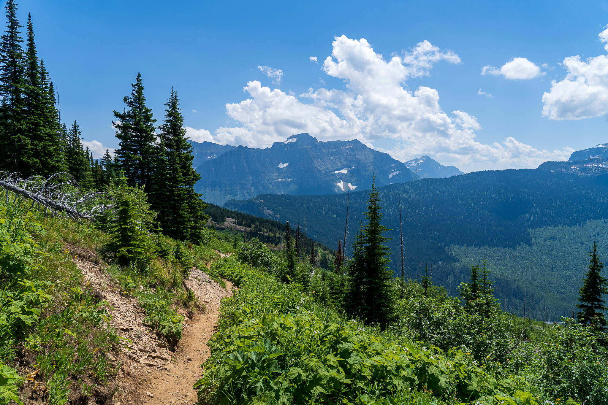
Once we finally reached the bottom, we continued on the Highline Tail, nearing the Granite Park Chalet, which we’d been able to see in the distance for a couple miles prior. The chalet was built in 1914 by the Great Northern Railway to provide backcountry accommodations to tourist visiting the park. The railroad built several chalets, but only two have survived.
Highline Trail - The Loop
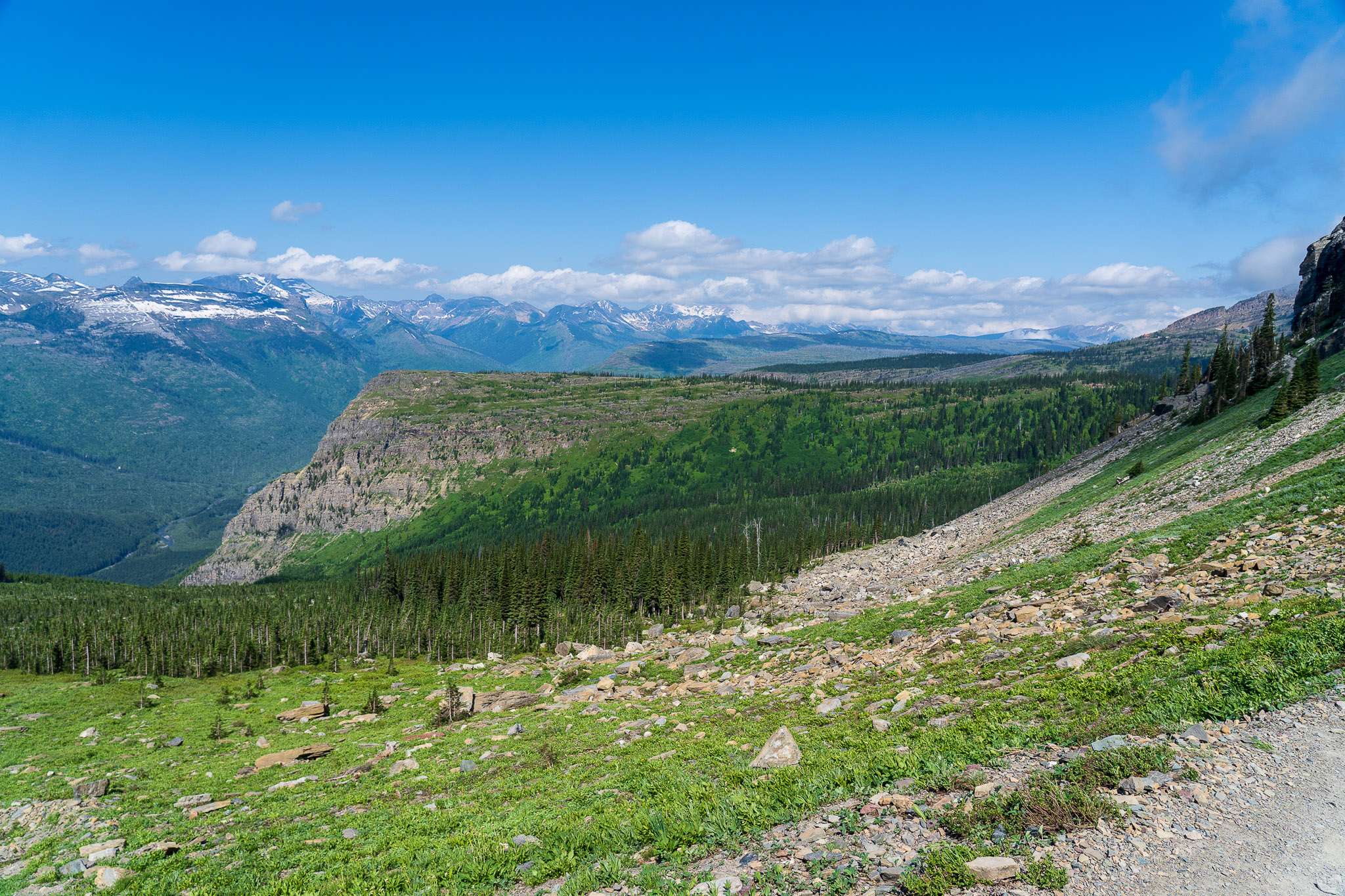
From the Sperry Chalet, the trail splits. You can go north on the Continental Divide Trail, crossing Swiftcurrent Pass and eventually ending up at the Many Glacier region of the park. While I would love to take that route one day, we didn’t have the time, so we opted for the shorter route. From the Chalet, the Granite Park Trail descends and rejoins the Going to the Sun Road at “The Loop” parking area.
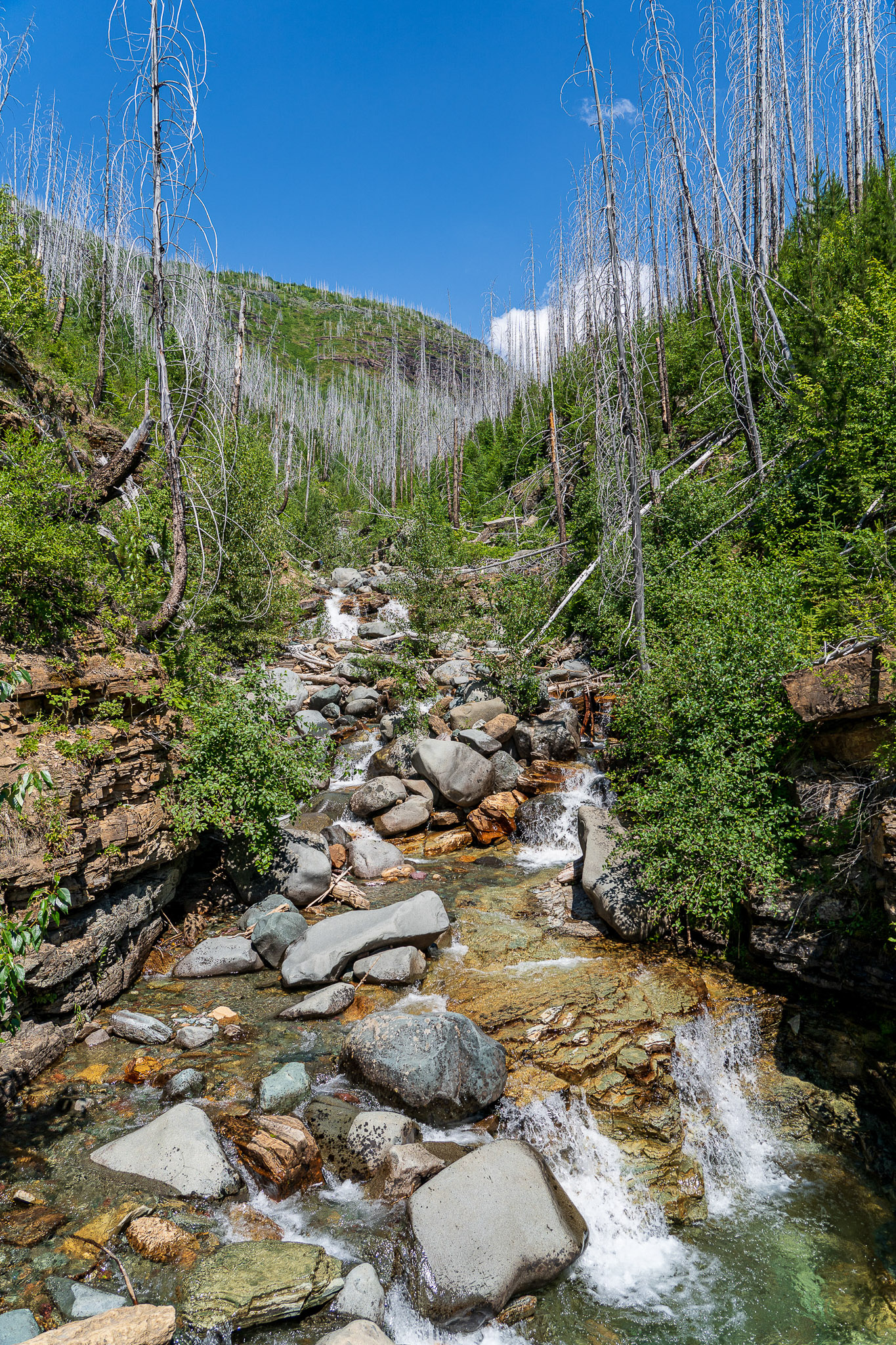
By now, I was starting to become concerned about our timeline. I’d messed up, and didn’t realize it was still another 4 miles down from the Chalet to the Loop. At some point, I did manage to receive a text from Dad (turns out the Garden Wall is high enough to have decent cell coverage) saying they were running late. However, I didn’t realize that most of the Granite Park Trail passed through areas fairly recently stripped by fires, raising the ground temperature a good 10-15°F. As you might imagine, I didn’t stop to take many pictures in this area.
While we did see some wildlife and some good views of Heaven’s Peak and some waterfalls, we mostly hustled back down to the car. In my opinion, this was even more challenging than climbing up to the glacier overlook, because it was dusty, downhill, hot, and at the end when we were already tired. Faith and I actually ran the last mile or two, maybe more.
The hike took us a couple hours longer than we anticipated, partly due to spending extra time at the overlook, and partly because the descent to The Loop was much more difficult than anticipated. We’d planned to go to our cabin to clean up before going to eat dinner, but ended up not having time. Our final trekking distance was 16.2 miles.
Dinner - Tupelo Grill
One of Dad’s friends had recommended Tupelo Grill in Whitefish. Whitefish is about 15-20 minutes west of Columbia Falls, and is a neat, though touristy, town. We had a reservation at 17:30, but ended up arriving 30 minutes early, right when they opened. Apparently it’s a popular place, because we had to wait, even that early in the evening.
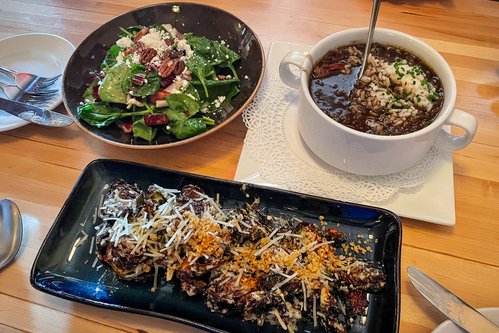
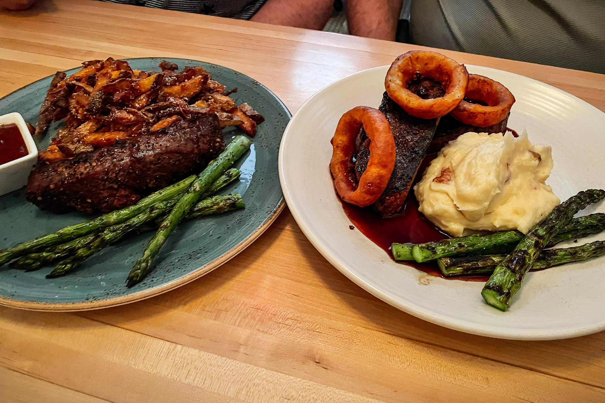
We were all extremely hungry by this point, but our patience was rewarded with a truly phenomenal meal. To start, Faith and I split their Brussels sprouts (fried, with bread crumbs, parmesan, and caesar dressing), Dad ordered some Tupelo gumbo (with chicken and andouille sausage), and Mom got a summer salad (spinach, goat cheese, strawberries, pecans, golden balsamic vinaigrette). For the main course, Mom ordered steak frites (local top sirloin with parmesan-truffle fries and house steak sauce), and Dad got the elk meat loaf (with roasted garlic whipped potatoes, huckleberry demi-glace, and crispy onion rings). Faith and I split an arugula salad (shaved fennel, pine nuts, pecorino, watermelon radish, and a meyer lemon vinaigrette) and the dry-aged bison cowboy ribeye (16oz bone-in, blue cheese, fried shallots, bordelaise, and seasonal vegetables).
This was an incredible meal, and I’d recommend it to anyone visiting the area. The bison ribeye was without question the best steak I’ve ever had.
Tupelo Grill
Whitefish, MT

This was a truly exceptional meal. Make sure you get a reservation well in advance, as it books up quickly!
* – Would definitely visit again
** – Exceptional, must visit if you’re in the area
*** – Worth making a special trip to eat there
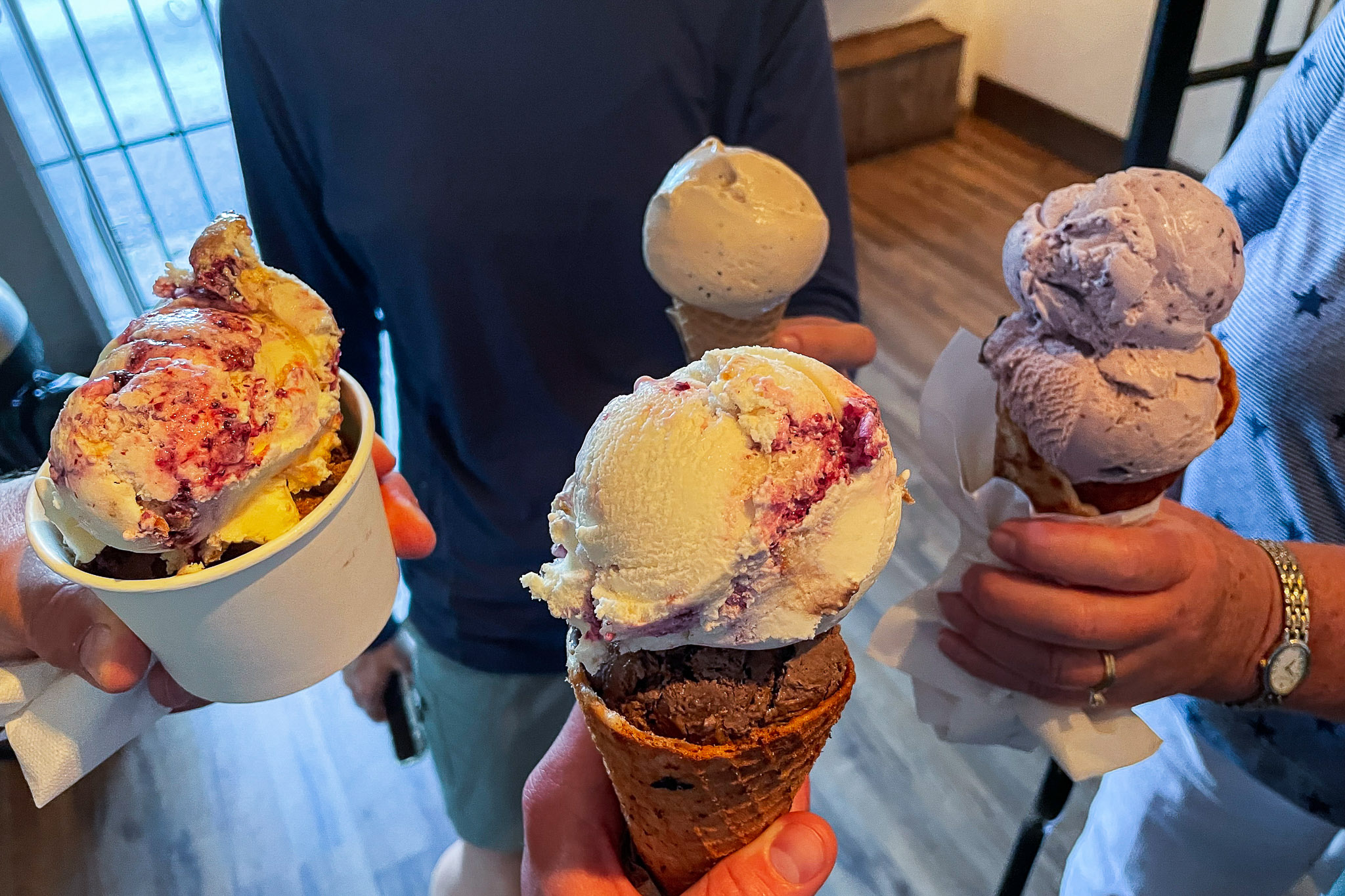
Ice Cream - Sweet Peaks
After dinner, we meandered a couple blocks over to Sweet Peaks Ice Cream, a Whitefish-based Montana ice cream chain with creative flavors, high quality ice cream, and excellent house-made waffle cones. We tried several flavors, including huckleberry-lemon pie, espresso, huckleberry, “Under the Big Sky” (blueberry-vanilla swirl), “Chocolate Love”, and Flathead cherry chocolate. This was definitely the best ice cream we’d had so far…even better than Shumway Farms.
Sweet Peaks Ice Cream
Whitefish, MT + Other Locations

Really good ice cream, especially the huckleberry-lemon pie. They have some unique flavors, but nothing “weird”. Everything we tried was fantastic!
* – Would definitely visit again
** – Exceptional, must visit if you’re in the area
*** – Worth making a special trip to eat there
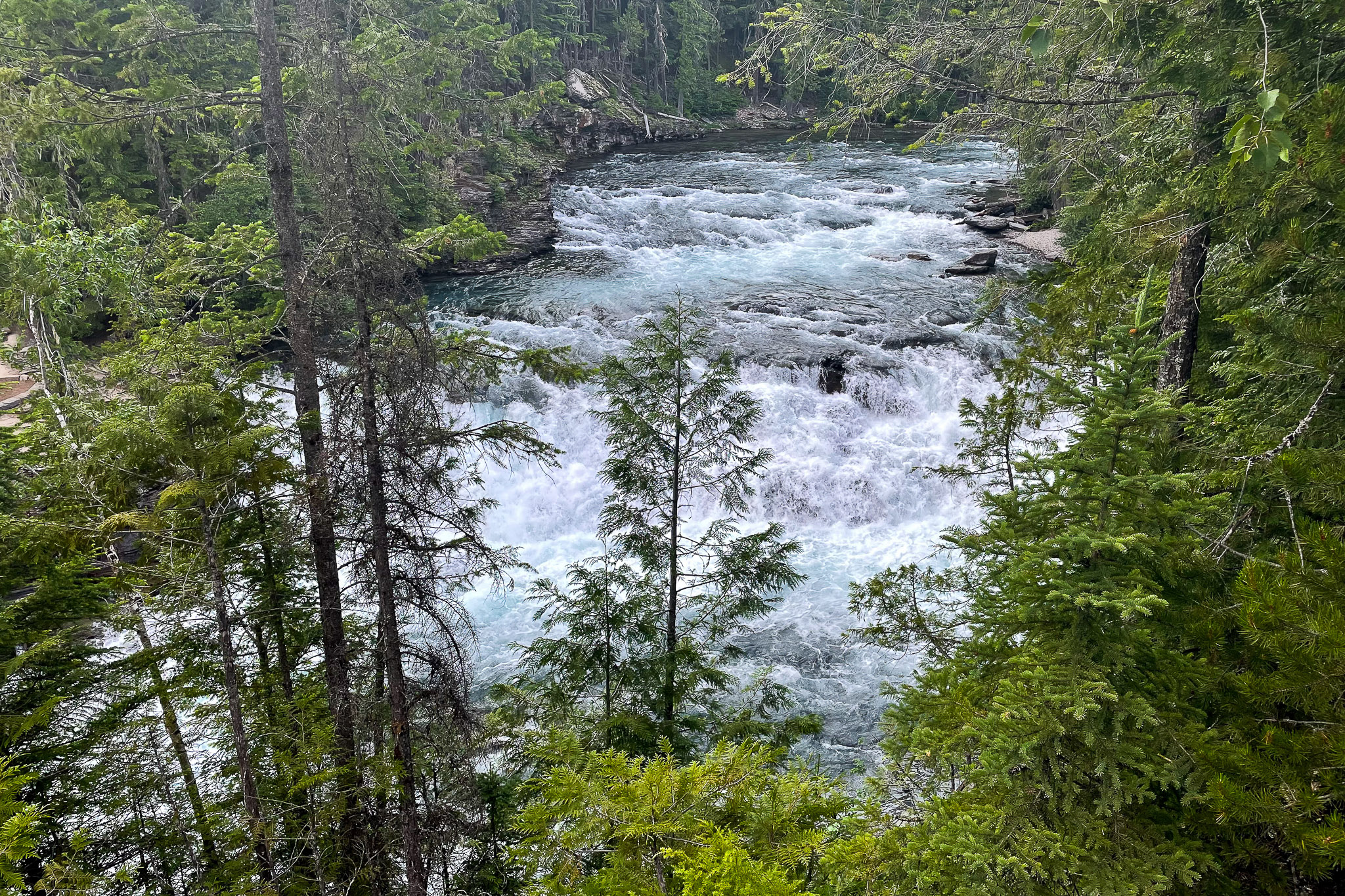
McDonald Falls // Lake McDonald
After dinner, we quickly checked into our new cabin in Hungry Horse, just SE of where we’d been staying in Columbia Falls. Thankfully, we’d be in this cabin for 3 nights, a nice reprieve from bouncing around lodging spots the past week. Before it got dark, we promptly headed back into the park for another quick evening adventure.
We drove past Lake McDonald Lodge once again, this time stopping at McDonald Falls, just above the far end of the lake. It’s an easy roadside pullout, offering uncomplicated access to an amazing view.
Faith and I decided we’d jump in the lake, since we were tired and sore. We’d felt the water the night before, and the temperature was pretty tolerable. Tonight, that was not the case…it was frigid. You can see the video Dad took below.
Impressively, Faith swam for a couple minutes. I gave up after only getting in up to my knees. Nonetheless, the cold water felt good to our sore feet. Faith was shivering by the time we got back to the cabin.
The Best Things we Saw Today
Isaac
The best thing I saw today was… “Grinnell Glacier and Grinnell Lake from atop the Garden Wall Overlook, when the clouds broke”.
The best thing I ate today was… “the dry-aged bison cowboy ribeye, and second place goes the huckleberry lemon pie ice cream”.
Faith
The best thing I saw today was… “the Highline Trail at the beginning when the fog lifted, and the Garden Wall section”.
The best thing I ate today was… “the bison ribeye”.
Jerry
The best thing I saw today was… “Going to the Sun Road”.
The best thing I ate today was… “elk meat loaf”.
Amy
The best thing I saw today was… “the view from Big Bend on the Going to the Sun Road”.
The best thing I ate today was… “my summer salad at dinner”.
Video
Watch the video below to follow us along our hike! Also, you can see our attempts to swim in Lake McDonald.
Conclusion
Thanks for reading! Click here to subscribe to our email notifications.
– Isaac, Faith, Jerry, and Amy
7 Responses
Photographs are wonderful!
You and Faith must be really experienced hikers. That is fantastic!
Enjoyed the photos and commentary!
Thanks!
The pictures from the long hike are beautiful. Amazing, spectacular views.
I CAN PLAINLY “SEE” WHY YOU GUYS WILL NEVER FORGET IT! WE SERVE AN AMAZING CREATOR!
ALMOST feel like I was there🤣🤣🤣🤣. Wonderful pictures. And the swim was invigorating!
Beautiful
Great pictures and videos from the hike. We were only able to do some short hikes so this was exciting seeing the views from up there. And, Isaac, I’m with you on the swimming attempt. Lake McDonald cut me off at the knees and that’s all I could do. With Raynaud’s, like your mom, my feet ached for hrs. Just looking at Faith swim in that water makes me hurt. Thanks for sharing your beautiful travels!
I really wish we could’ve done more of the longer hikes. The Highline was actually not the longest hike I hoped to do in Glacier, but time unfortunately limited us. We had to “settle” for slightly shorter hikes the rest of our time there. All the trails were great though. I quickly learned that it was often worth it to only do the first part of the longer trails, and then turn back. That also saved you the trouble of navigating back to your car.
Unfortunately, Mom passed her Raynaud’s down to me, but it’s not as bad…yet. Hopefully, it’ll remain mild.